


That was tough, but a great adventure! This is my first ever FKT and I”m really excited about it! This is a beautiful place to run and a great trail. I’ve been watching this FKT route since about October 2020. I wanted to try it in December 2020 when visiting family, but I had a run injury at that time and I was not able. I live in Michigan, so I don’t often have a chance to run this trail. I do visit family in Austin annually, and I’m surprised there are not more FKT routes in the area.
It was pretty exciting and a bit nerve racking that two people both took about 40 minutes off the OKT unsupported time for this route on two separate runs only about 1-2 weeks before my planned visit. I was looking at it periodically, so I saw the new times when they got posted. To make this even more interesting, two days before my run, one of my friends (Kevin) from Colorado said he will be in Austin next weekend for a wedding and plans to run this loop. Ha! Supposedly, he wasn’t even aware of the FKT time ;). Kevin is a very accomplished ultra runner and much faster than me, so I know I will only hold this for a very short time (unless he decides to run it “supported” style).
I did this run unsupported and carried all my own nutrition and hydration. I think I nailed my caffeine dosing. I also managed to take only 1 bathroom break, which is awesome for me. I stopped taking caffeine ~12:30 pm (about 2 hours into my run) to avoid interfering with my sleep tonight. If I had been closer to the current FKT, I might have continued to take caffeine later in the run to help avoid the slow down I experienced. But I also recognize that all the caffeine in the world may not have helped me when I was pretty fatigued. I avoided fruits and veggies pretty hard yesterday to help minimize bathroom stops. No major GI distress during the run, so I'm really pleased with my nutrition & hydration. I took 4 salt stick tablets (2 of them on 2 occasions, at probably ~1.5 hours and 3 hours), carried 2.5 L of fluids (2*500 mL flasks of Skratch superfuel and 1.5 L of water on the back of my Salomon S-lab 8L pack), I ate 1-2 cliff bars (1 was espresso coffee flavor, I think I only ate 1 cliff bar actually), 1 Spring gel (Hill Aid), and drank most of the superfuel. I had some cliff blocks (~3-4 of salted margarita) and I finished with fluid and calories left over (planned to carry enough for 5 hours in case I took that long). According to others, there are easy places to refill water along the way. But I didn’t have a chance to scout them ahead of time and I didn’t want to mess around looking for them during the attempt, so I carried lots of fluid. I never saw any during my run, but didn’t look for them.
I am really pleased to run this well (for me) given that I haven't slept that great at the camp ground (some rowdy neighbors and stuff) and I didn't really taper for this much. Weather was good, thankfully! I did feel the wind in some of the exposed areas.
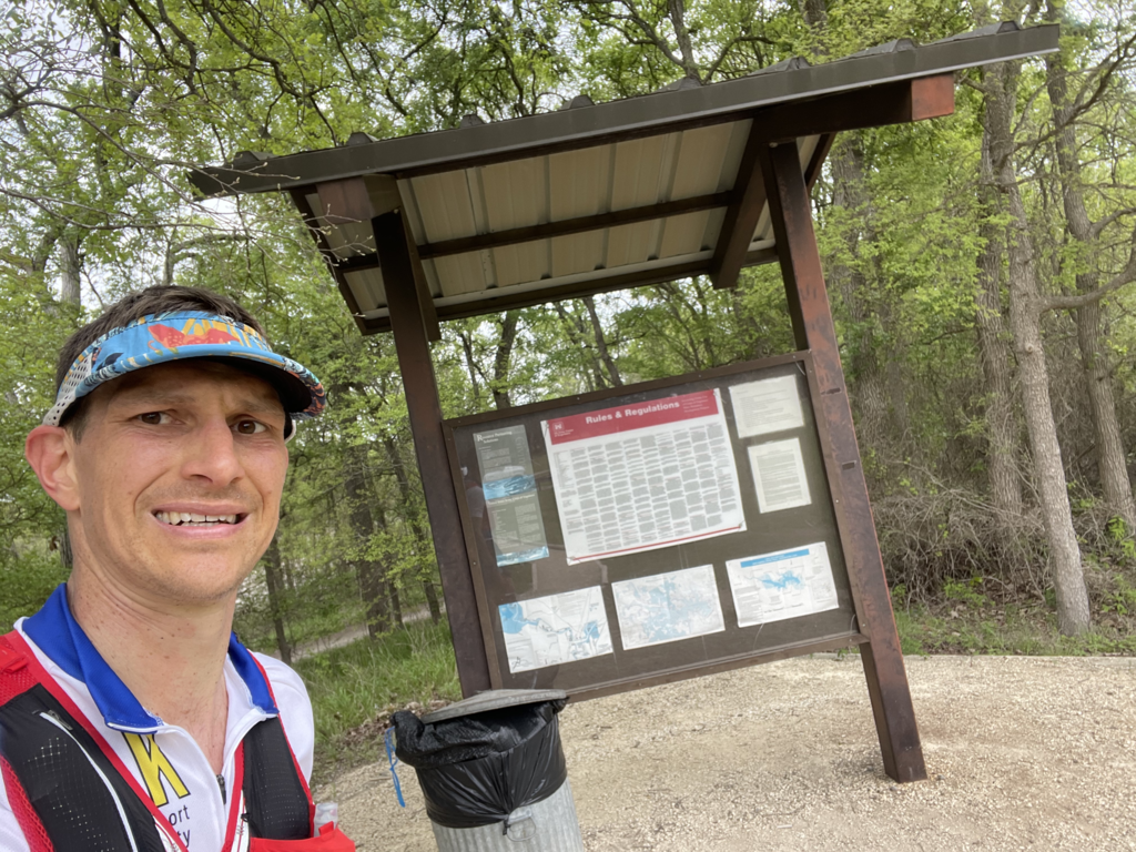
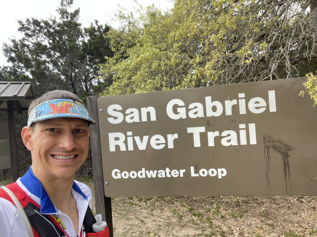
I started at the Russell Park trailhead (see photo of me by the sign) since we were camping there. I took a photo of me by that sign at the start and the end. I knew that miles ~1-5 and 10-17 would be relatively rocky and technical based on a little scouting and reading other’s reports. I agree with others that these sections of the trail are *very* rocky and difficult to run fast. Other FKT reports suggested the last 5-10 miles would be mostly flat and fast. That is relatively true, except there were a few big hills during my last 10 miles and the last mile was rocky too. I went really slowly for the last mile, partly because I was exhausted and partly because I knew I had the FKT with time to spare and didn't want to risk falling on the rocks. I managed to do the whole run without a single fall, which I am super happy about. But I did have some close calls. I felt like I was high-stepping over mini-hurdles during those miles rather than running. But that is part of the “fun” of trail running, I guess. ;) Also noteworthy that the Strava segment for the marathon held on this route starts and ends in Russell Park. That was another reason for me to start and end here. But disappointingly, strava did not match my run with that segment. I’ll have to see where my route deviated from that route, if at all (maybe just the wrong turns I made). I know segments don’t always match on trail runs from my R2R2R in October 2020. We had about 8 people in our group do the exact same run and some segments registered in one person’s run, but not another person’s run.
Not surprisingly, I did make a few wrong turns, but I never wandered too far off the trail and my wrong turns always added distance or ran // to the actual trail. First, when I was in Jim Hogg park, the trail bends to the right right before a side trail . An access trail runs out to a road and parking area. I ran out to the parking area, then tried running down the road, then realized the trail to the right (that I originally thought was as “side trail,)” was the actual trail. Then there was a scenic overlook to the right and the trail goes to the left. There are signs there directing hikers, but the signs were not super clear to me. In an open area before the dam, there are two // trails. Just after crossing the river on the west end, there are again two // trails. I ran the one closer to the river, but I think the one a bit further up was the one one the gpx. Also, there seemed to be several places between Tejas park/western river crossing and Russell Park where someone could bypass a lot of the route (in addition to the spot with the mile 15 mile marker that other FKT holders have described). In some of these cases, it looked like the more direct “bypass” trail was more well-used. So future FKT-ers will need to be sure to run the longer loops rather than the most direct path. I also took the side loop with the mile 15 post that others have mentioned, even though it seems “out of the way.”
I tracked this activity on my i-Phone with strava and that said 28 miles and garmin connect said 27 miles based on my forerunner 935. The route is supposedly 27. The file on strava is the gpx file from garmin connect. HR data didn’t get moved over to strava. I guess I should’ve used a different file format.
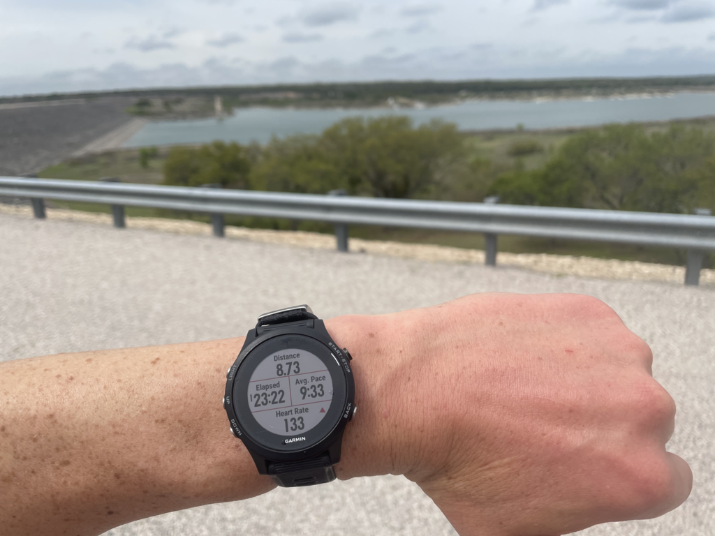
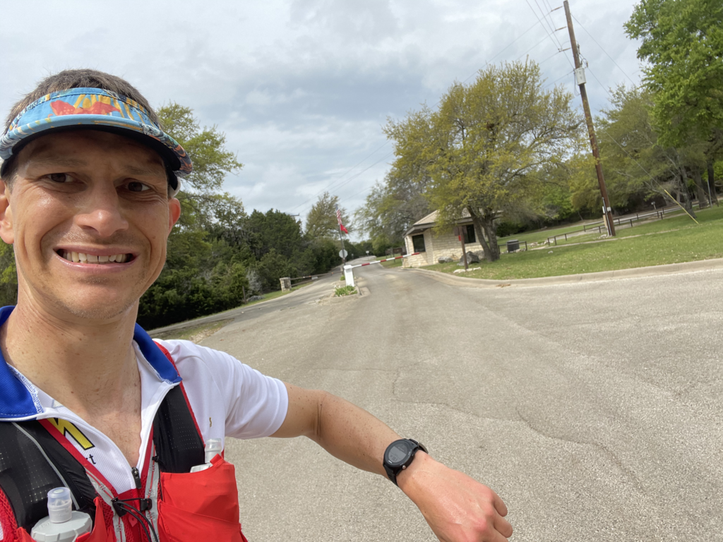
I used a Garmin forerunner 935 with the “navigate” option. I need to see if I can have the map further zoomed in. It shows an arrowhead to indicate your direction of travel. When I came to a fork in the trail, the arrowhead was so big that I would have to travel down one trail for a while before I could see whether or not I was still on course. I know the Garmin is also supposed to be able to alert me to being “off course.” But I found this alert to be less reliable than looking at the map. I also need to remember to optimize my navigate activity screen. There were several screens I wasn’t using and some metrics I did want to see that were not there (I intended to do this before the start, but wanted to get going). I was also worried that my activity/watch might have an issue if I started my run in a place that was different than where the gpx started and ended. When I got near the western river crossing, the map on my forerunner 935 showed a red icon. I was worried it was considering that the end of the route and that it would stop recording or something. So I ran up into a parking lot and snapped some pictures of myself by a sign and my watch to have evidence of where I was at that point.
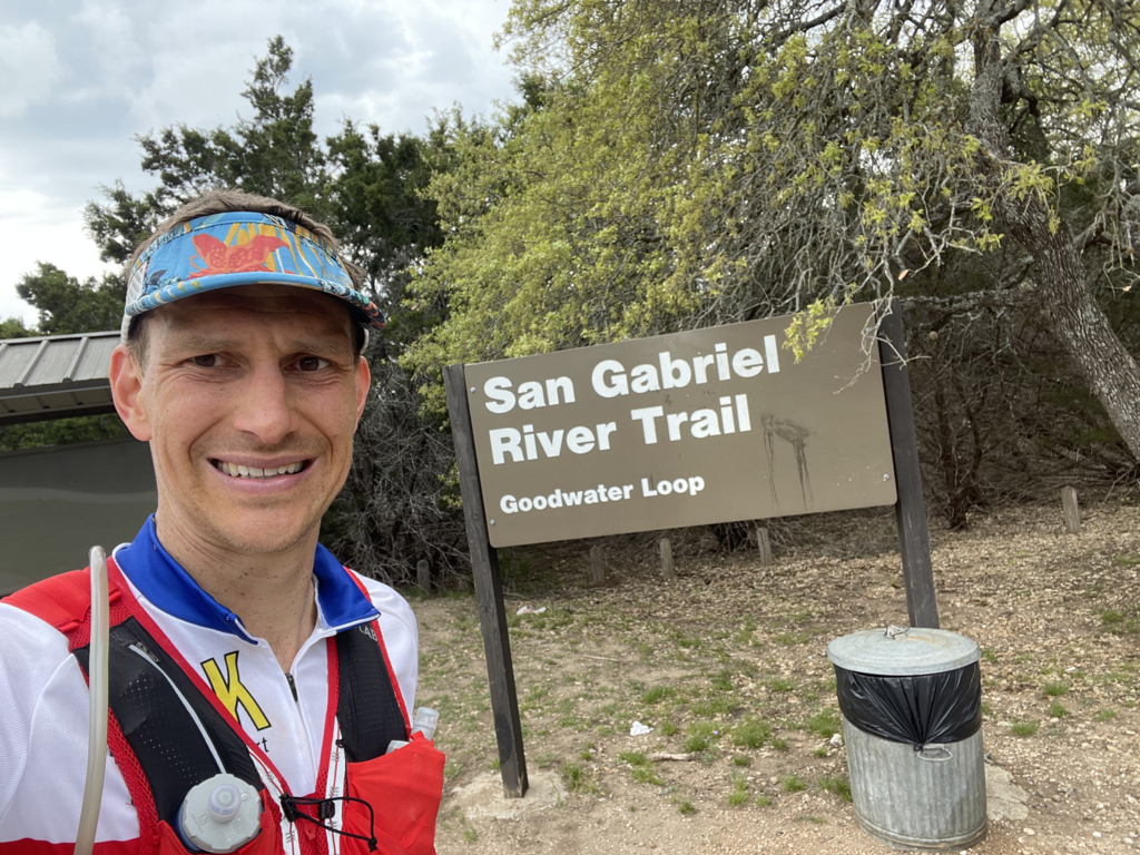
I took pictures at several locations along there route and some scenic areas. I took a lot of pictures of the gnarly rocks near Russell Park (just east) when I mountain biked some of the trail the day before to scope it out. I posted those pics in my strava activity. I honestly think it was easier to run some sections of this trail than MTB them.
Hoka speedgoat evos felt great. I notice the day after this, I had a big cactus needle sticking out of the top of my left shoe. Luckily, it didn’t penetrate deeply enough to pierce my skin.
I know in the past, I’ve run 2-3.5 hour runs with an average HR in the low 140s. So I tried to start this run on the “easy” side by keeping my HR in the 130s for the first 5-8 miles when I felt really good. When I got to the 7 mile rocky section I had taken my remaining caffeine and it must have had a strong effect. I didn’t speed up, but I was racing through that terrain pretty hard, which I can see now based on my HR. I didn’t look at my HR much in the rocky sections because I had to keep my eyes on the trail. When I got through the final rocky section (mile 10-17), I knew the trail would be much less technical. So I was hoping to lock in a HR in the 140s and cruise fast and hard for the final 7-10 miles. I did put out some faster miles in this stretch, but the cumulative fatigue combined with some hills was too much, so I definitely had some slow miles in there too.
I did walk some of the uphills even in the first 5 miles when I was really fresh because of my experience with longer trail runs and what I’ve learned about the efficiency of running vs. walking uphill from Science of Ultra podcasts. In retrospect, I should’ve walked more of the uphills early on (and that thought did cross my mind early at that point). I walked more uphills in the mile 10-17 section because I was more tired and the terrain was technical. And funny enough, by the last 5-10 miles, I walked almost ever slight incline because I was pretty spent at that point. Despite that, most of my splits at that point weren’t slower (or even faster), because the trail was so much less technical.
I definitely recommend people try to avoid having the rocky sections (just east of Russell Park for ~4-5 miles and miles 0-7 west from Cedar Breaks park) at the end of their run. As others have mentioned, the risk of a trip and fall seem high.