Desert Trail Completed: Mexico to Canada
The final leg of a hiking trail from the Mexican border to the Canadian border has just been mapped by members of The Desert Trail Association. In the idea stage for at least 40 years, the concept evolved over the succeeding years into a border-to-border trail. Establishment of the final route involved extensive map studies, on-the-ground verification, and coordination with Bureau of Land Management and other public land-use agencies through which the Desert Trail passes.
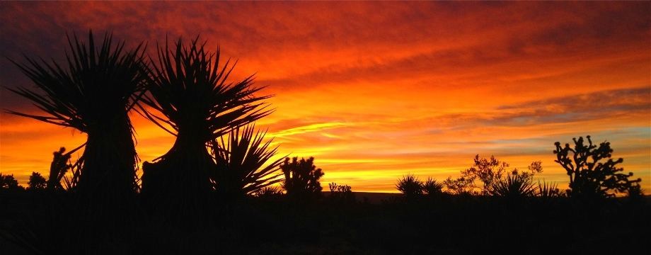
The Desert Trail traverses over 2233 miles of the low and high deserts of the Western U. S., running at times through California, Nevada, Oregon, Idaho and Washington. Unlike the widely-known Pacific Crest Trail farther to the west, which follows a set route through the Washington and Oregon Cascades and California Sierra Nevada Mountains with numerous trail markers, the Desert Trail features point-to-point navigation. Hikers are guided by compass, geographic features, map reading and GPS coordinates as they move along the non-motorized trail. The trail incorporates some existing trail routes, wilderness sections, and lots of open desert.
The southern end of the trail begins at the Mexican border near Jacumba, CA. Heading north, it skirts to the west of Salton Sea and the Imperial Valley, and across the Mojave Desert to Death Valley. It continues through Nevada and the Black Rock Desert, into Oregon at the Pueblo Mountains, through the Alvord Desert and Steens Mountain, the Columbia bench lands of Northeastern Oregon, Idaho and Washington, and reaches the Canadian border in the Selkirk Mountains.
The final northern-most leg was completed last summer by Bruce "Buck" Nelson, a retired smoke jumper and thru-hiker from Fairbanks, AK. He began at the southern end March 1 of 2012, and completed the route--more than 2200 miles--on July 11 of 2012, not only the first to hike the entire trail, but first to do it in a single traverse.
Complete information on the various Desert Trail segments, including mileages, GPS coordinates, physical terrain features and water sources, can be found on Buck Nelson's website at www.bucktrack.com/The_Desert_Trail_Map.html Information on the Desert Trail Association is available on the DTA's website www.thedeserttrail.org .
David Green, Desert Trail Association
portlandtribune.com/msp/132-sports/159294-desert-trail-group-maps-huge-hike
Bruce "Buck" Nelson appears to be the only person to thru-hike the entire Desert Trail.
For a long time the desert was just looked at as the place where you dump waste, you put military bases, you run your motorbikes all over the place, you mine it and leave a big mess. It's important to get people to understand that the desert is a beautiful and complex place and also that it's a place that's worth preserving. There are very few people who will destroy a place through which they have just carried a 60-pound pack for three days. - guidebook author Steve Tabor
The Desert Trail is more of a route than a trail. Conceived by Russell Pengelly, the Desert Trail Association (later in collaboration with the Desert Survivors) worked to develop the route with the ultimate goal being a National Scenic Trail from Mexico to Canada. The official route currently runs from the California-Mexico border through California and Nevada, and ends in southeastern Oregon, around 1500 miles total. Nelson hiked the route, then continued on via a route of his own design through Oregon, Washington and Idaho, to the border with Canada, a total of 2223 miles. Nelson pre-set dozens of food and water caches for the first 1000 miles, returned (by car) to the Mexico border to retrieve the caches, then laid out 20 more caches in northern Nevada and part of Oregon.
Nelson provided the following useful links about his hike and the Desert Trail:
bucktrack.com/Desert_Trail_Thru-Hike.html (Introduction with some historical info on the route)
bucktrack.com/The_Desert_Trail_Map.html (Map)
postholer.com/Colter (Journal)
bucktrack.com/Desert_Trail_Guide_Books.html (Guide Books)
bucktrack.com/Desert_Trail_Gear_List.html (Gear List)
The route is mostly cross country walking through desert, washes, across dry lake beds and along ridge lines. In places the route follows wild horse and burro trails and 4WD trails. In some places the route follows gravel roads. Most “road-walking” is in places where vehicles are rarely seen... Obviously hiking over 2,000 miles is considerable work any way you cut it, but although there are hundreds of miles of cross-country travel most of it is fairly easy going and there is less climbing than on any of the well-known “Triple Crown” trails. - Buck Nelson
The Desert Trail passes north from the Mexican border through the deserts of California, Nevada, and Oregon. It is not a constructed trail, but a hiking corridor the hiker/backpacker may use to access some of the West’s most remote and fascinating territory. The California Section of the Desert Trail passes through four parks and seven Wilderness Areas in the southeastern corner of the state… The Nevada section of the Desert Trail passes through ten Bureau of Land Management Wilderness Study Areas and two National Wildlife Refuges in the western third of the state." - Steve Tabor
The idea for the Desert Trail is you take your compass and walk from one waypoint to the other. A waypoint is a place we have set aside to say 'this is where you are now' and you point your compass to go to the next waypoint. - Steve Tabor