


LA Freeway, August 2022 (report written May 2024)
Motivation
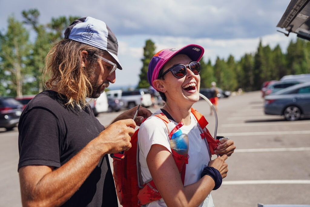
Kate: This line requires an intimate familiarity of the high peaks looming in what feels like the backyard for locals to the area. Further, it demands a series of skills: running, scrambling, off-trail navigation, endurance at relatively high elevations. I was also aware that at least one overnight would be required for me, necessitating comfort in the dark and with added fatigue. The LA Freeway served as a test piece for the various skills I had gained and improved upon during several years of running, scrambling, and climbing around Colorado. Importantly, my tenure in Boulder was coming to an end, and this would likely be the last summer I could dedicate to spending weekends scouting the line from the house and giving it a go. Traversing the LA Freeway felt like a very aesthetic and powerful way to say goodbye to a beautiful home and chapter. I presented the idea at large to Hailey – at the time I was unsure if I’d try alone, with my partner, or otherwise. Hailey later followed up with interest, making the decision easy… what’s better than a big outing in the mountains? That with a good friend.
Hailey: It’s possible to get a complete view of the LA Freeway from a few of Boulder’s skyline peaks, or further east. It’s the kind of line that simultaneously makes the heart leap and the stomach drop (at least for me): it’s equal-parts inspiring and intimidating. After gaining some meager familiarity with the route’s bookending peaks (Longs to the north; North and South Arapaho to the south) over the past two years preceding our attempt, I had only given the full line thought in abstract terms. I knew that I’d like to go for it sometime, but I figured that time might still be a couple years off. However, after meeting Kate in late summer of 2020, we’d become regular running and scrambling partners and when she broached the prospect of doing the LA Freeway in summer on a winter run in early 2022, I couldn’t help but be intrigued. I felt that we would be well-matched partners—in terms of not only ability and comfort on the technical sections, but also from a dedication and preparation perspective—and I also felt a certain reassurance at taking on the daunting line together.
Preparation
Kate: We spent four days (detailed below) scouting components of the line throughout July, focusing on areas we knew were most challenging with respect to route finding or climbing. We used several trip reports to select areas of the line to scout, of note, Mountain Project and descriptions from Kyle Richardson, Cordis Hall, and Peter Bawkwin. We both had a fair amount of experience with the most northern and southern portions of the route, but much of the middle was new to us. In hindsight, our scouting days were huge highlights to my summer. The Wild Basin in particular presented some of the most peaceful and spectacular time I’ve ever spent in the Front Range.
Hailey: As Kate mentioned, identifying the crux sections of the route and centering our scouting days around those sections was key. Just getting up to the Divide for each of these individual runs made for worthwhile and memorable outings. Of course, it would have been ideal to essentially live at elevation for the weeks leading up to our attempt but neither of our schedules and myriad obligations allowed for that. In addition to our recon trips up to the Divide, Kate and I were also able to get in a mid-June S-N Arapaho run; I went up Longs Peak twice in June/July, and I think I got up above 10k’ for a handful of other runs. Zooming out further, Kate and I got out for near-weekly runs up Green Mountain in Boulder together and near-weekly scrambles for a few months leading up to our LAF effort.
Scouting days included, in sequential order:
- Buchanan Pass to Pawnee Pass to navigate Paiute: Starting and ending in the Brainard Lake area, we moved counterclockwise (early July).
- Isolation Peak from the Wild Basin Trailhead: We did this counterclockwise starting on the Wild Basin Trail, veering north to the end of the Boulder-Grand Pass Trail, past the Lake of Many Winds to gain the ridgeline, and returning to the trailhead past Isolation Lake and via the Bluebird Lake Trail (mid-July).
- The end of the route from Shoshone to South Arapahoe: We started from the Long Lake Trailhead and gained Pawnee Pass to summit Shoshone, Apache, and Navajo, continuing on the ridgeline to Deshawa, North Arapaho and then South Arapaho, returning to our dropped vehicle at the Fourth of July Trailhead (mid-July).
- Circumnavigation of Glacier Gorge to scout the downclimb off of Longs Peak to Pagoda and the downclimb off of Pagoda to Chiefshead: We did this clockwise, taking the North Longs Peak Trail to Flattop, Storm Peak, and Longs Peak, and returning off of Arrowhead to the Glacier Gorge Trail (late July).
Gear
Kate: I wore the La Sportiva TX Guides for the duration of the Freeway. No troubles, I think my feet would have hurt after this much time on them, regardless. I carried the Salomon Advanced Skin 12L Running Vest, which I continue to love for long outings. I began the journey in a t-shirt and shorts and carried a wind layer for top and bottom, and a light down layer for the nighttime, with mittens and a buff. Otherwise, I carried 2x headlamp, Garmin inReach Mini, and a portable battery pack. I also had my iPhone and Garmin Fenix 6 watch, which unfortunately died quite early with the nighttime cold (that had never happened before and has not happened since… tools must have sensed my metaphorically dying insides, see below).
Hailey: Started in tech tee, shorts, La Sportiva Mutants, thin merino socks and a hat. Carried: Ultimate Direction Vesta, light wind shell (Pearl Izumi), La Sportiva rain paints, arm warmers, synthetic LS insulated jacket, buff, gloves, 2x headlamp, sunglasses, Garmin InReach Mini, small first-aid kit, carbon Black Diamond poles, 1.5L water bladder, Katadyn filter flask (.6L), .6L spare flask and food.
Fueling
Kate: I carried ~6000 calories for the duration of the traverse (250 kcal/hour for a predicted 24 hours). This was a combination of liquid calories (caf and non-caf Maurten Drink Mix, Cola flavored Tailwind, actual Coca-Cola, some iced coffee) and solid food (shot-blocks, burritos, energy bars of choice, etc.). At this point, ~1.5 years later, I don’t quite remember what I ate or when, except that I had an unfortunately challenging stomach early on and for most of the journey. Liquid calories saved me, so fortunately we could fill our flasks relatively frequently (see below). I had the capacity to carry ~3L of water (1.5L in a Camelbak, 1L in soft flasks, and 0.6L Katadyn filter).
Hailey: I started the day with ~6500 cal, a combination of real food to eat earlier (chips, 3 x burritos, small packets of olives, 4 x Pro bars) then more sporty food for later (Tailwind, Maurten gels, packets of Hammer Perpetuem, Gushers). In retrospect, I think I would change my fueling somewhat significantly—I don’t like the Hammer products enough to fuel that long with; Tailwind generally seems too salty for my constitution and Maurten’s caffeinated gels are too much on my stomach. Instead, I’ve been really enjoying Skratch’s high-carb and electrolyte mixes and Maurten’s non-caffeinated gels. I’d keep most of the real food—assuming a 24-hour effort were still the goal—but maybe trade out the burritos for pb&js.
Water
Summer 2022 had been particularly wet, such that we did not have trouble finding water. Of note, we were able to fill our flasks in the Longs Peak Boulderfield, heading south off of Chiefshead, below the ridge of Isolation Peak to the west, Buchanan Pass, Pawnee Pass, and the tarn between Navajo and Arikaree.
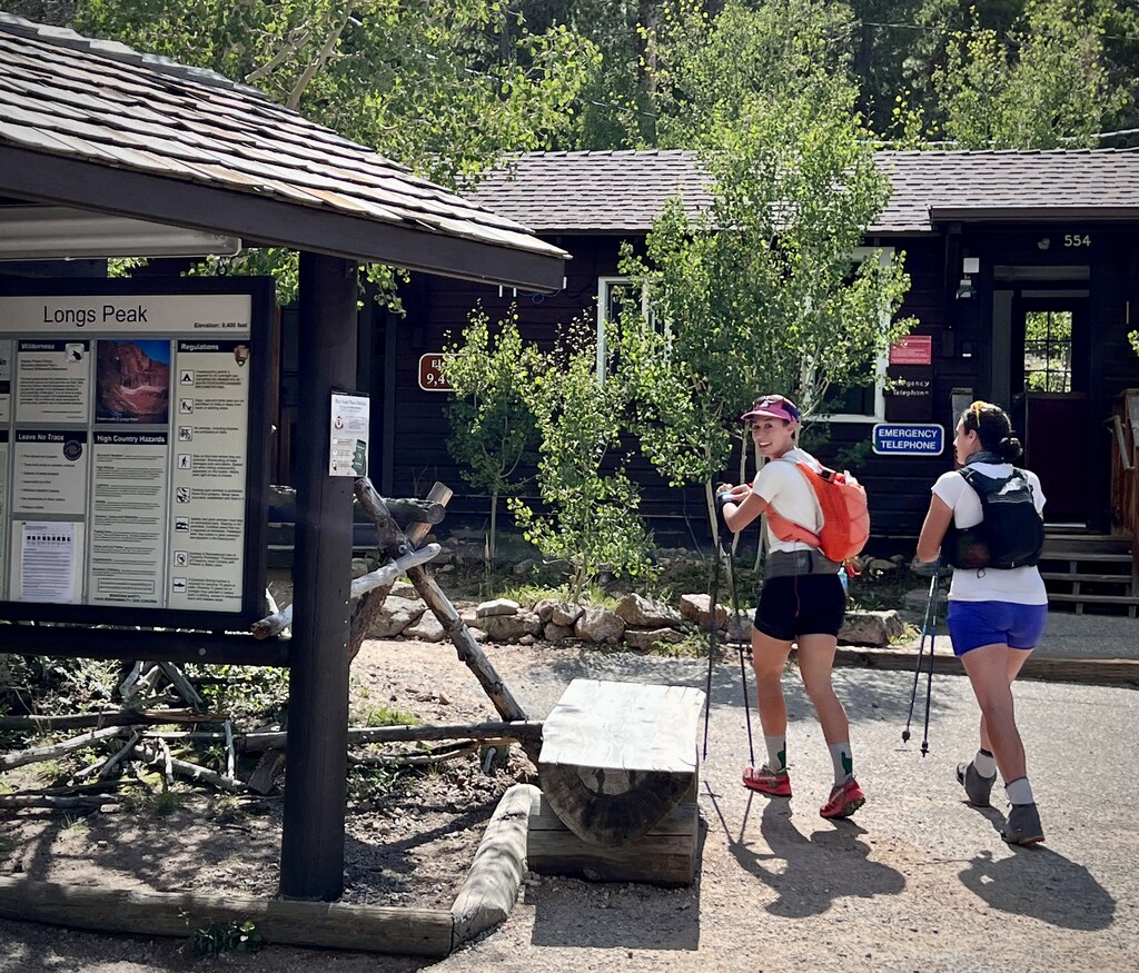
The successful attempt
Kate: We began our attempt on the LA Freeway at ~3:40pm on a Wednesday afternoon (August 3). The weather looked great, and we ultimately had no surprise weather – clear and warm during the day, clear and chilly at night.
We easily reached the summit of Longs via the North Face/Cables, no trouble with downclimbing to Pagoda – peeling off from the Keyhole Route – or downclimbing the bypass to Pagoda’s West Ridge to then summit Chiefs Head. After a stunning sunset, we were in the dark by the time we reached the top of Mount Alice. For no particular reason, Tanima was disorienting and simply felt much further east than expected. We botched the nighttime navigation up and around Isolation Peak, missing the third-class gully after navigating the grassy ledges on the west side. We backtracked and eventually gained the summit. We mentally recovered on the relatively easy tundra section (Ouzel, Ogallala, "Ooh La La", Point 1227, Red Deer, and Buchanan Pass), although I recall moving quite slowly across that terrain with fatigue and stomach discomfort from what felt in response to elevation and likely nerves. The sun rose as we looked toward Paiute from Sawtooth Mountain, and after a friendship check-in we decided to keep going over to Algonquin, then onto Paiute.
Unfortunately, Paiute was maze for us this time around (compared to our scouting day), and we navigated too low on the west side of the ridge. We eventually found the system of cairns and the sidewalk/ledge (“rubbly horizontal break” on MP) leading us out of a series of loose, third-class gullies to regain the ridgeline and solid rock. We gained Paiute and had another check-in about continuing, knowing we could soon bail off of Mount Audubon or Pawnee Pass. We moved on to Mount Toll—this one was fun again… was my stomach turning for the better? Pawnee Peak was simple, and we carried our momentum to Shoshone and Apache. The 5th class chimney continues to be a favorite part of this line to gain the summit of Navajo. The descent off of Navajo was awkward but fine. And the “sidewalk in the sky” to gain Arikaree was also quite fun as we watched golden hour arrive (again), and we geared up for a challenging and unplanned second evening on the Freeway. As predicted, we got turned around gaining Deshawa, but (finally) nailed our line up North Arapaho, and then South Arapaho felt like clockwork. Opting for solid and reliable footing, we stumbled down the Arapaho Glacier Trail, arriving at the Fourth of July Trailhead at 5:50am on the morning of August 5, 2022 (~38h 09m), exhausted but triumphant.
This route exceeded my expectations in aesthetic and challenge. I am grateful to have deeply experienced this full-value line.
Hailey: Had I known just how challenging this line would be, I might not have thought my accrued experience in the mountains as of summer of 2022 was up to the task—but I guess that’s kind of the point with these grand challenges, and it’s an experience that I think back on with gratitude every time I look at the Divide. Having now seen the line myself, I’m even more captivated by this link-up and the diversified skillset it demands for a successful, much less efficient, run. To echo Kate’s sentiment, the days we spent scouting different sections remain some of my most cherished days spent in Colorado and I feel fortunate to have shared the full LAF experience with Kate. For a more detailed play-by-play recap of our 1.5 days+ on the LAF, I wrote extensively about the journey in the days following on Strava:
https://www.strava.com/activities/7592976217
Style and GPX track*
It was our intention to complete the LAF in unsupported fashion—and that is the style we followed through reaching the summit of North Arapaho. Given the wet summer in Colorado, we felt confident about there being ample water on route, and—as previously mentioned—we both set out from the Longs Peak TH carrying all of the calories we hoped to need with no pre-arranged caches. However, given the unanticipated second night on the Divide, our partners were understandably concerned for our wellbeing. Kate’s now-husband Nick met us on the summit of North Arapaho and Hailey’s partner, Tony, met us on the final descent, about 1.5 mi from the 4th of July Trailhead. In the spirit of honest adherence to the generalized definition of a “supported” effort, we submit our women’s record time as such, though after spending 1.5 days navigating the challenges of the Divide on our own, this feels like a formality. Regardless, the experience remains our own, and we hope more women pursue this challenging line.
Both of our watches died on route, Kate’s quite early; Hailey’s on Red Deer (likely due to having to use the screen light during night-time breadcrumb trail navigation). Hailey started Strava on her phone, but it auto-paused for one significant section of the route (Shoshone-Pawnee). Splits are given based on the times we have from watch tracks and/or photo/video time stamps that we recorded during our LAF completion.
Splits
Longs Peak: 2h 37m
Pagoda: 3h 33m
Chiefs Head: 4h 45m - stopped for a few mins here to adjust packs/layers; filtered water on the southern slopes
Alice: 6h 25m
Tanima: 7h 10m
Isolation: 10h 7m
Ouzel: ???
Ogalalla: ???
"Ooh La La": ???
Point 12227: ~14h 50m
Red Deer: ???
Sawtooth: ~16h 10m
Algonquin: ~17h 11m
Paiute: 20h
Toll: ~21h 27m
Pawnee: 22h 04m
Shoshoni: ???
Apache: ???
Navajo: ???
Arikaree: 28h 19m
Deshawa: ???
N. Arapaho: ???
S. Arapaho: ???
4th of July TH: 38h 08m 38s