Military Ridge Trail, Dodgeville, WI to Madison Wisconsin, 40 miles (nominal)
September 7, 2019
Conditions: 55 degrees at the start, 95% humidity, 6:10 AM, so nearly dark, but not necessary to start
with a light. Forecast for mostly cloudy, but sun was never really blocked for long until the last 5 miles of
the run. Temps at the finish 73 degrees F. Light west wind (2-3 mph) all day, but rarely felt due to tree
cover. Trail was dry apart from one underpass that always holds water
Report: The Military Ridge Trail runs through my hometown of Verona, WI, and it is a regular venue for
both running and cycling, being both fairly flat and free from a lot of interruptions. The idea of
completing a Fastest Known Time attempt first came to me in the late winter or early spring of 2019. At
the time, I did a little looking on fastestknowntime.com and found that there was a segment
established, but no records at the time.
Little did I know that another Verona resident also had plans for a Military Ridge FKT attempt, and
Stephanie Dannenberg became the Fastest/Only Known Time for the trail on June 6, 2019 with a time of
9 hours, 21 minutes, 17 seconds, having completed her effort in an unsupported fashion. You can read
her blog of the experience here: https://irunmountains.blog/2019/06/07/only-known-time-military-
ridge-trail/. I reached out to Stephanie in July to confirm my interest of the same endeavor, and she was
very encouraging, saying she thought the trail is a great place for a first FKT attempt. In true runner
fashion, she was already thinking of going back to better her time.
I’m very familiar with the eastern 15 miles of the trail, since this is close to my home, but saw the
western 15 starting in Dodgeville only once during a training run before the attempt. Conditions vary
along the trail, but in general the western section has more tree cover and a crushed rock surface that is
not as well maintained. Much of the rock base has been covered over by dirt, and since there is less
traffic, there is abundant low plant growth on the trail. This continues until roughly Barneveld (15 miles
in). The eastern portion of the trail to just beyond the city of Verona has a wider, better maintained
crushed rock base and many wooden bridges in various states of mostly disrepair. Tree cover varies
from good to absent. The final 2.5 (or 3.3) miles of the trail are asphalt covered.
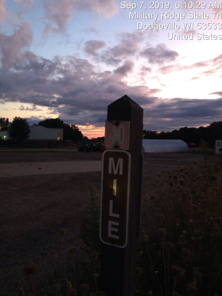
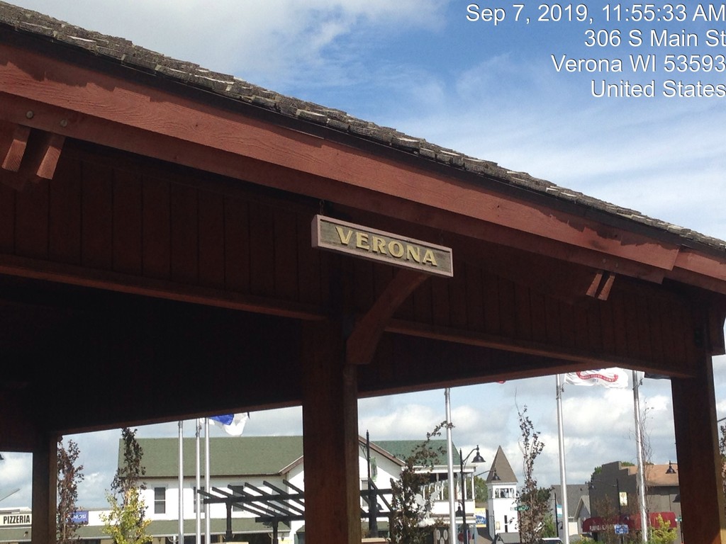
The day started early with a breakfast of oatmeal and a 30ish minute drive to Dodgeville. For both the
training run as well as the official attempt, I took a cue from Stephanie’s effort, starting with HWY 23 in
Dodgeville immediately behind me, and a sign denoting the Military Ridge State Trail being ¼ mile down
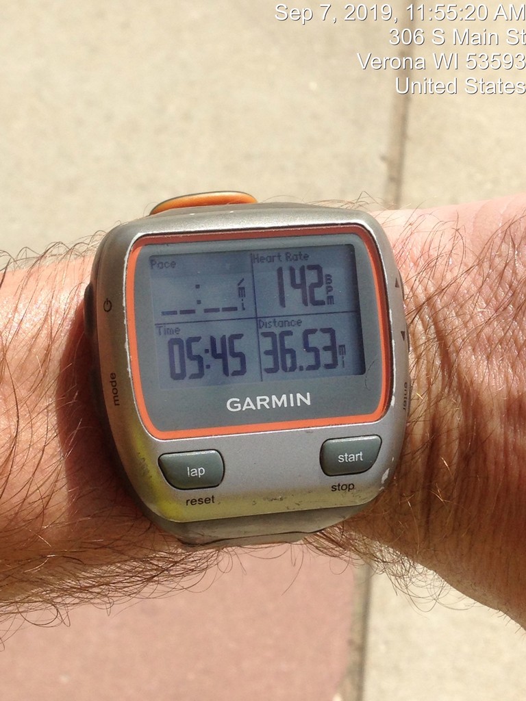
the narrow path ahead. After documenting the location, and starting up two Garmin’s, a wrist-worn
Forerunner 310XT and an Edge 500 carried in my waist belt (both with auto-pause features turned off), I
started at 6:10 AM.
The effort started with some walking, as my waist belt had a small pocket that made it difficult to cram
in a phone/camera, the Edge GPS, and nutrition. I also had a single bottle, at first filled with Skratch
hydration mix, since in contrast to Stephanie’s attempt, I was being supported by my wife. The first
several miles were relatively uneventful. As in my training attempt, I was trying to settle into an easy
pace and being mindful of my HR. Previously, I had planned walking breaks every three miles with a
longer break every 6 miles. Today, I was going to try to take advantage of the cool weather early, and
knowing where a few short inclines that I would plan to walk were, I would just run while I could and
walk when HR started to get too high, or I hit one of those inclines. At first, it was a little higher than I
wanted to see right out of the gates, but that was likely adrenaline, as it came back to normal levels (mid
140’s) after a couple miles. I ate half of a Lara bar around mile 5, and the rest of it as I came into the first
checkpoint at Ridgeway, where met my wife to exchange a half empty bottle of Skratch for water and
downed a Honey Stinger Waffle. I kept moving (walking) through this entire stop, in retrospect, I’m not
sure it would have mattered, but a brief stop may have been helpful later on.
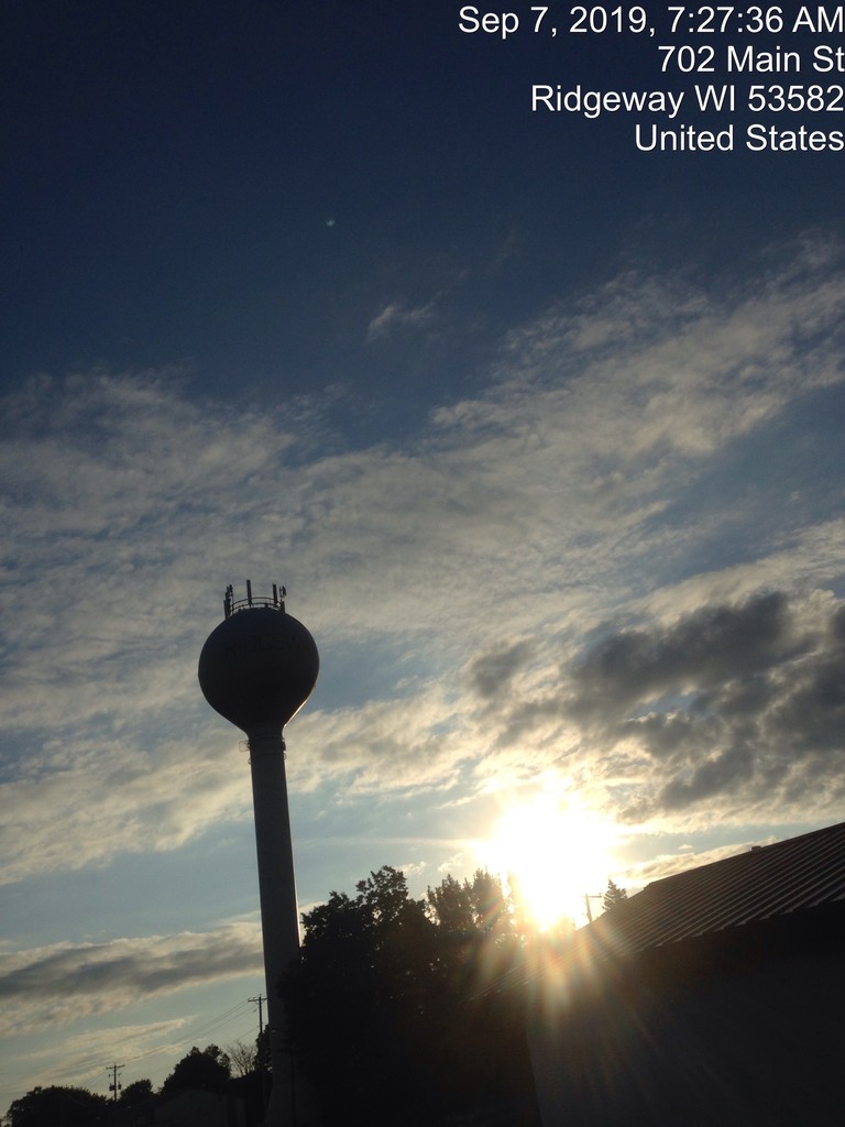
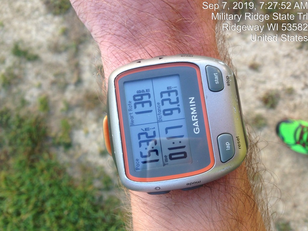
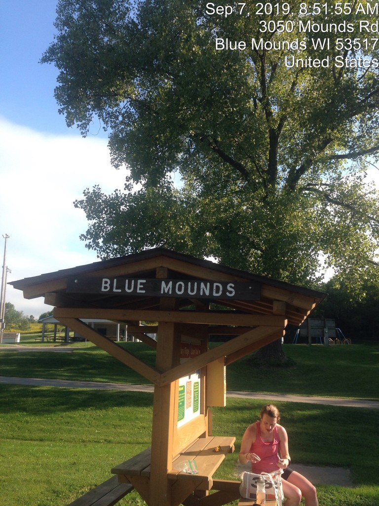
The next planned meetup was in Blue Mounds, at roughly mile 19. Of note, my wrist GPS recorded 0.03
miles of walking getting to the first mile marker on the trail (mile 40), but had been steadily gaining
ground on the mile marker posts. This became a bit frustrating later, but was also the reason I had the
backup unit for verification. The trail from Ridgeway to Barneveld at mile 15 is relatively uneventful as
well, there is very little traffic on it, so it was just me, farm fields, and the sounds of nearby HWY 18/151.
The rolls up and down a bit through here, with only about 100’ of elevation change over 6.5 miles. Still,
somehow it seems like the trail is almost always going up!
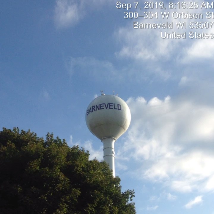
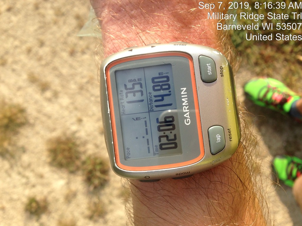
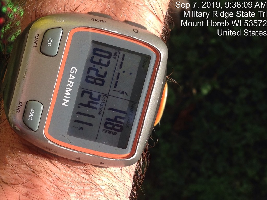
In Barneveld, I took a quick second to snap a pick of the water tower and my progress according the
wrist GPS, ate a pack of Clif Shot Blocks and then carried on. From Barneveld, the trail drops down a
little bit, before grinding steadily back up to the town of Blue Mounds. One section is 1.5% grade for a
little less than a mile, so it’s never awful, but it sneaks up on you. Paradoxically, this uphill section of trail
was also one of my fastest sustained sections of running. HR had already been moving up a little faster
than in the previous attempt, and this effort didn’t help things, but perceived exertion was still relatively
low, and every time I tried to back off a little bit, the pace just crept up again.
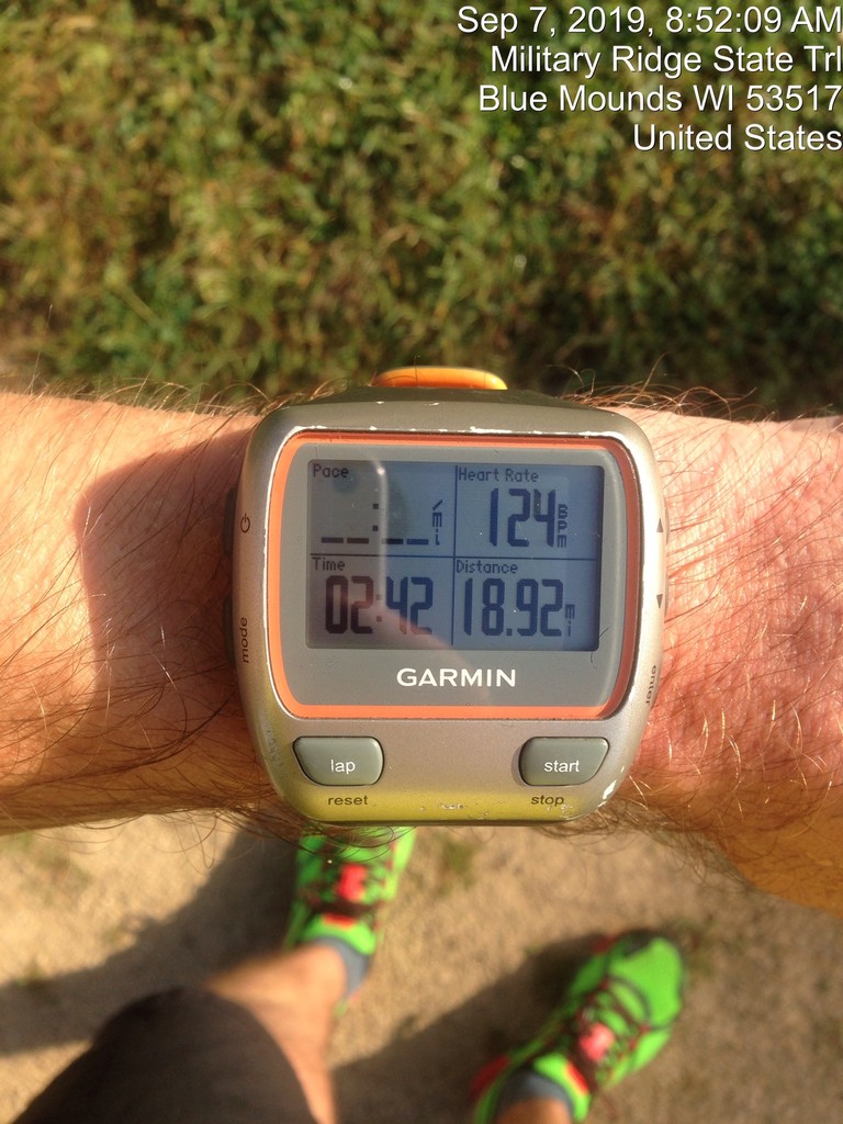
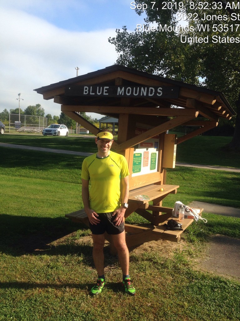
I stopped for refreshments at a small-town park, and with no water tower in site, took a shot of the
small shelter adjacent to the trail. Up to this point, I hadn’t stopped moving apart from two very brief
trailside bathroom breaks. But some of the small stones had worked their way into my shoes and I
wanted to get them out before things got worse. I switched out for the remnants of the original bottle
of Skratch (about ½) and a pack of fig cookies along with another pack of shot blocks, and I was off
again.
This section had been the death of me previously. Having ridden the bike through it before, I knew there
was a longer uphill section, but somehow what looks like it is always uphill is actually a net downhill of
0.2%. With heart rate already starting to creep up more rapidly, I planned to be more conservative this
time, and was going to shorten my running intervals in this section. On one portion that actually does go
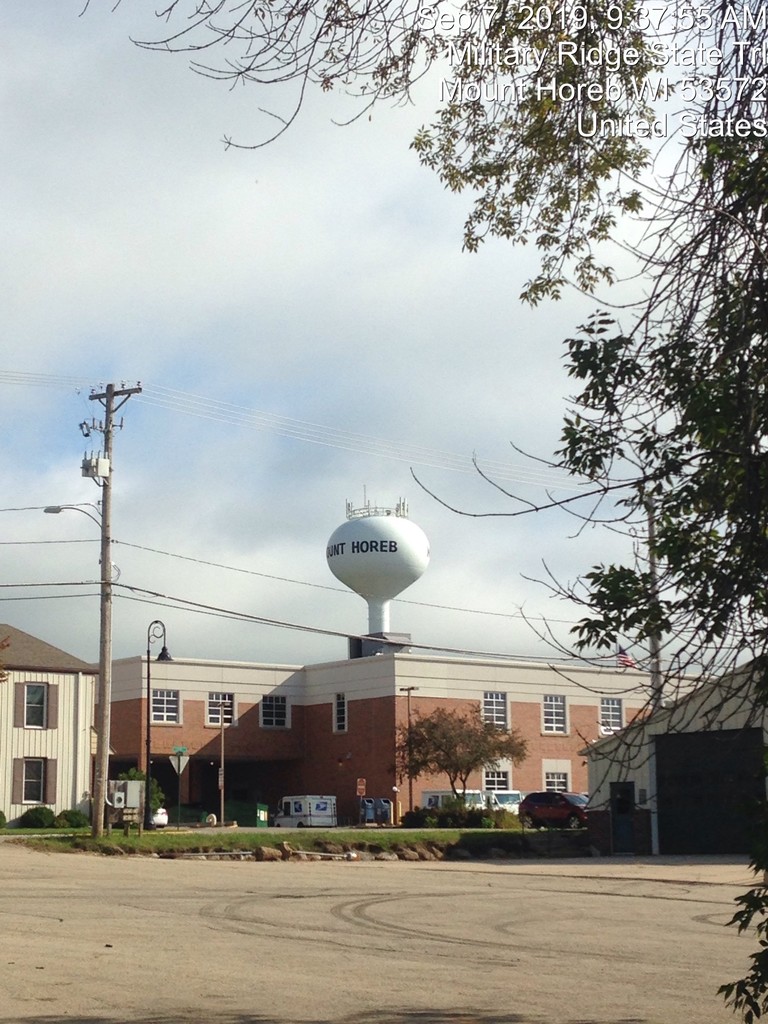
uphill, I walked, but by the time I got into Mt. Horeb, HR was into the 170’s. Now at 24 miles, I knew this
would be trouble, as there was still a long way to go, and this was the same situation I’d found myself in
during the training run.
After a longer ½ mile walking break, taking in a bit more food, restocking supplies and bottles from my
wife, I headed out again. I was pleased to see that the longer break (walking the whole time) had
allowed heart rate to come down more effectively this time, and the trail heads mostly downhill from
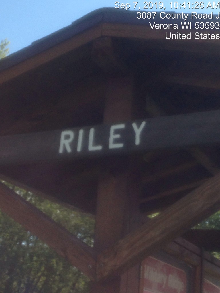
Mt. Horeb to the small one-corner community of Riley, just beyond 30 miles. There’s not much there,
just a few houses and a bar – and a Military Ridge State Trail Trailhead. The downhill sections of the trail
were nice, heart rate still climbed quickly and perceived exertion was definitely on the rise, but I could
maintain my same running speed around 8:00-8:30 min/mile while moving and just take more frequent
breaks. Much of the trail was also shaded fairly well, which was nice, since the forecasted cloud cover
never really came into play. There were certainly clouds in the sky, but the sun kept ahead of them
almost all day. After crossing HWY P in Klevenville (another community that barely exists), there is an
open section that heads into a long, shallow bump of a hill, just to go back down into a flat marshland
area. I kept the run going until I hit a bridge near the bottom of this bump and then walked over the top
to limit the damage. My left hip flexor was starting to tighten up a bit, especially after walking breaks
when I was trying to keep moving rather briskly, and then transitioning back to a running gait. I didn’t
really want to start running again, but knew it was roughly a mile to Riley and I had a chance to refill
there.
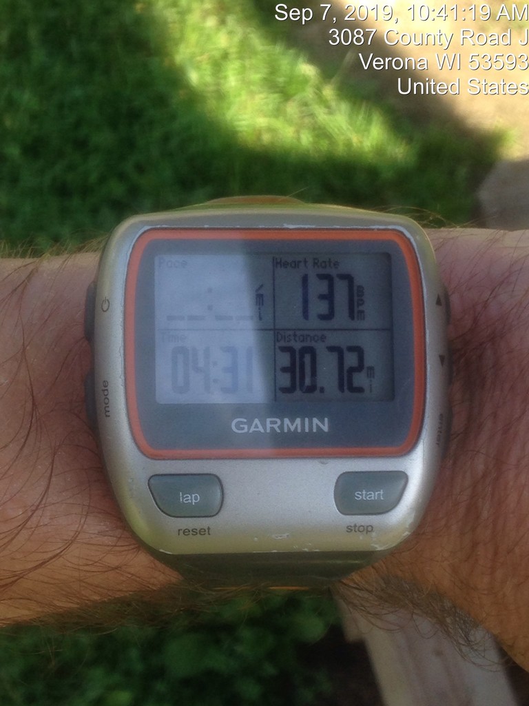
Riley was my second full stop. Going into the attempt, I had targeted a 6-hour finish. I was technically
still on pace for it (8:45 pace at Riley), but I could tell that the way things were headed, it was going to
be out of the question for today. So I opted for a slightly longer stop, both for recovery as well as to
change my socks. The original pair was sopping wet, and there are few things I dislike about running
more than sopping socks! My stomach was also starting to feel a little questionable at this point from all
of the sugary sports nutrition products, so I went with some caffeinated Shot blocks and another bottle
of Skratch, knowing solid food was not going to treat me well.
The next section of trail was one I know well, and one I was dreading. The first 1.5 miles has small
patches of tree cover, but now being about 10:30 am, the sun was relatively high in the sky and the
trees weren’t doing much in a lot of places. I started with a longer walking break, about 1.3 miles to try
and get my body to reset and heart rate to come down a bit, and it seemed a little like it had, with 138
bpm for a brisk walking pace (around 14-minute miles). Not ideal, normally that effort should be closer
to 120, but better than the 170’s I was seeing while running. The next section is about 3 miles of wide-
open wetlands. There are a few sections of tree cover, but at this time of day they do nothing. From
HWY PD to the first underpass bridge for HWY 18/151, the trail is flat, and I was hoping to run as much
of this as I could before the trail ticks up again toward Verona, but within ¼ mile of resuming running,
my legs started giving me signs they wanted to cramp. I don’t often cramp, but this effort was
exceptional, and I shut it down right away to avoid a full lockup. I was able to get back to running and
keep the speed a little faster for a time, but had to step very gingerly to avoid full blown cramps. Luckily,
they didn’t seem to be much of an issue while walking.
From the underpass, the next two miles to Main St in Verona are gentle 0.3% grade on average, with
some sections creeping up to 1.5%. This is an old railroad grade after all. I planned to walk all this from
the time I left Riley, knowing it was likely to spike my heart rate too quickly, but with the cramps
looming now, it was a definite. I just focused on keeping it moving, and then stopped briefly at the Main
Street pavilion in Verona to snap some progress shots and take the first sip of truly cold water I’d had in
almost 6 hrs, which was so refreshing.
Heading on from Main Street, there is about 1 more mile of crushed rock trail that goes slightly downhill,
and then the final 2.5 miles on asphalt that is slightly uphill, but much of it is almost imperceptible. I was
optimistically hoping to sprinkle in some running efforts on these downhill and flat sections to goose the
pace a bit, but it was not too be. I had a couple of false starts, but the cramps would come on almost
immediately and it just wasn’t worth it. I settled in for 4 (or almost 5) miles walking.
There’s not much to say about this final section, I was just walking. Trail traffic had been picking up
gradually as I got closer to Madison, as I expected, but it was still lighter than what I often encounter,
particularly on the paved section of trail, and never presented any issues in the least. Although I couldn’t
run, my energy was still OK for walking. Heart rate had climbed to the low 150’s for my 14-minute mile
walking pace, I was hot, and probably dehydrated to some degree, but not unbearably so. I still had
plenty of fluid, and a bit of food, so it was just a matter of finishing.
I took note of the mileage on my wrist GPS when I passed the 1-mile marker on the trail, just before the
final wooden bridge that crosses over Fitchrona Rd. It was currently reading 39.47, or 0.44 miles ahead
of what the posted mileage markers should have been. Meanwhile, the Edge 500 was reading 38.8 miles
so it was a little behind.
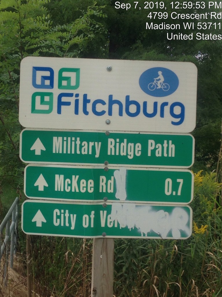
Stephanie stopped her attempt at a sign just before the bridge that takes the trail over McKee Rd. This is
a logical place to stop, as it is very close to 1 mile from the 1-mile signpost. There is also a small side trail
that goes to the right of the bridge and takes the trail up a sidewalk adjacent to McKee. Prior to the
bridge construction, the trail had gone to the right further back on the trail, and emerged at the corner
of McKee Rd and Verona Rd. It was a busy and dangerous intersection, which led to the creation of the
overpass. I was familiar with the sign where Stephanie had stopped, but planned to continue slightly
beyond it where the access trail stops at McKee. However, when I got to the sign in question, it showed
arrows for the Military Ridge Trail in both directions, continuing over the bridge. At that point, I elected
to continue on until there were no longer indications that any part of the trail remained ahead. I
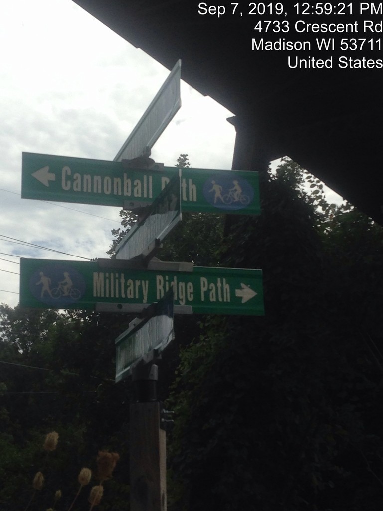
continued over the bridge to the 5-way intersection of the Badger State Trail, Capital City Trail,
Cannonball Path and Military Ridge Trail (technically it was referred to as the Military Ridge “Path” at
this point, I hadn’t paid close enough attention to the previous signage, so maybe this detour was
unnecessary.) Regardless, there was certainly nowhere left to go associated with the Military Ridge Trail.
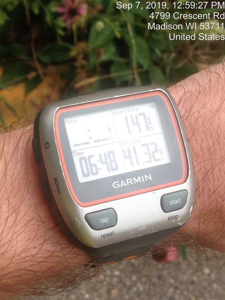
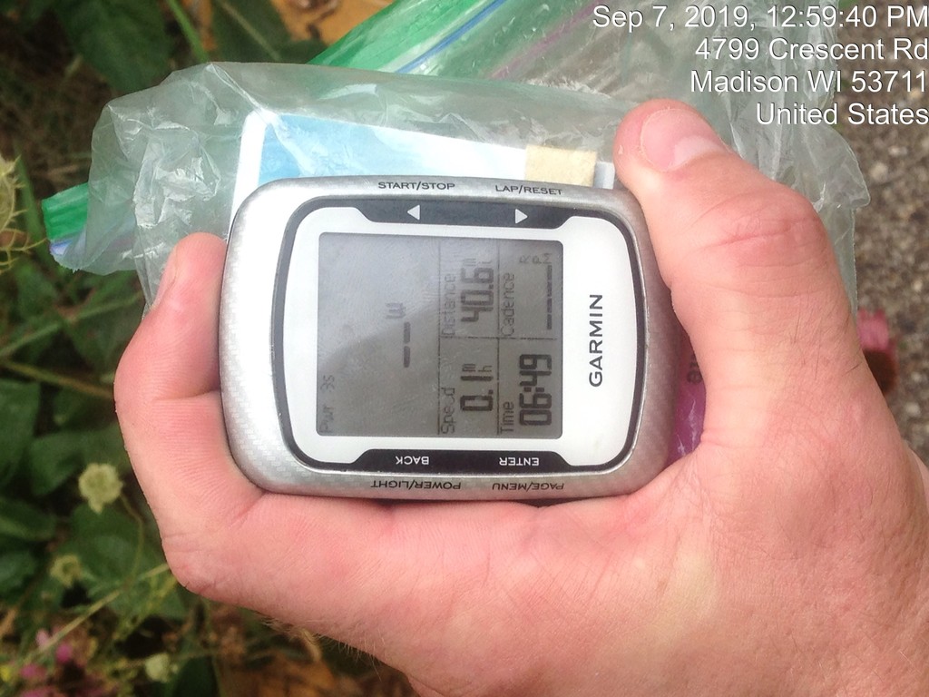
I stopped both Garmins, snapped a pic of the screen and the location and called it done.
Final times/distance: Forerunner 310 XT = 6:48:53, 41.32 miles, Edge 500 = 6:49:22 (stopped later)/40.6 miles
For comparison, to the top of the bridge in the center of McKee Rd, the times would have been:
Forerunner 310XT = 6:39:31, 40.6 miles Edge 500 = 6:39:23(started a few seconds later than the Forerunner), 39.9 miles
The 40.6 mile compares well with what Stephanie recorded, she noted that she had wandered a bit around shelters, I never left the trail by more than a few feet.
Overall, the attempt was a success, although much more challenging than I was hoping for. Conditions
were decent, hotter and more humid than I was hoping for, but we can’t control the weather. My longer
training runs had been getting better and better, and I was pleased with my training day on the trail, so I
was a bit surprised that the effort started to sink its claws into me at the same point as the previous
experience. Still, I was able to make to Riley close to my planned target effort, and hadn’t encountered
cramps in my training, so while I knew I was going to be walking much more in the last 10 miles, I didn’t
expect to walk nearly all of it. Even a little bit of running would have drastically sped things up. I do
sometimes wonder if I should have run slower while I was running. While there were certainly times that
I was pushing it a bit too hard, and I knew it, overall, my legs don’t seem to settle in very well below 9:00
minute pace. And my heart rate remains mostly in control at 8:00-8:30 for a while, so I may just need to
be more diligent about including walking breaks to keep it lower for longer. Once it starts climbing at a
pace that should be easy, it’s hard to bring it back down. I think my nutrition plan was good, I felt like I
had energy, but just couldn’t fully access it due to muscular stress. Training had certainly been suspect
over the past few weeks, more sporadic than it should have been with this attempt on the horizon. One
thing is always true of ultra-distance efforts, they demand respect, and they will make you pay if it is not
received. In spite of the challenges, I pushed on to complete an effort that I was only doing for the sake
of the accomplishment, and staying the distance in spite of resistance is a big part of that
accomplishment.