Witfontein Nature Reserve, near George, South Africa
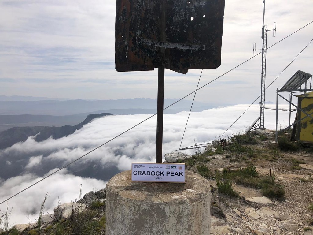
Cradock Peak at 1578m above sea level, is the highest peak in the Outeniqua Mountain range. The FKT starts at the Cape Nature Witfontein forestry station. Start Coordinates: (DD) -33.935678 ; 22.426987
The route first follows forest roads through the pine plantations to the base of the ... Read more
Witfontein Nature Reserve, near George, South Africa
Cradock Peak at 1578m above sea level, is the highest peak in the Outeniqua Mountain range. The FKT starts at the Cape Nature Witfontein forestry station. Start Coordinates: (DD) -33.935678 ; 22.426987
The route first follows forest roads through the pine plantations to the base of the Outeniqua Mountains. From here you take a footpath down across a stream and then you start climbing up the foothills, across the railway line and up. Be sure to take enough water, the stream you crossed is the only one and in the first, third of the route. On the ridge (the Saddle) you will encounter a T-junction, right for George Peak and left for Cradock Peak about two kilometers away. Close to the small weather station at the top a rocky scramble awaits that is sometimes slippery and not for the feint hearted.
Incredible views of the Garden Route landscape and Swarberge awaits on a clear day. Weather changes quickly in the mountains so plan your FKT carefully, always take warm and wind resistant clothing along, even if the forecast is sunny.
Stats: 8.5km 1300m ascend
More info @
www.facebook.com/CradockPeakFKT
www.gtrtrails.run
Read less