THERE IS BUCKETS OF PASSION IN THIS ROUTE.
https://www.bigvolcano.com.au/natural/wollum.htm
"As an Earth and Environmental Science High school teacher / ultra marathon coach, this is an area I've studied, mapped and taken students on high school field trips" - Simon Byrne.
Why do it?
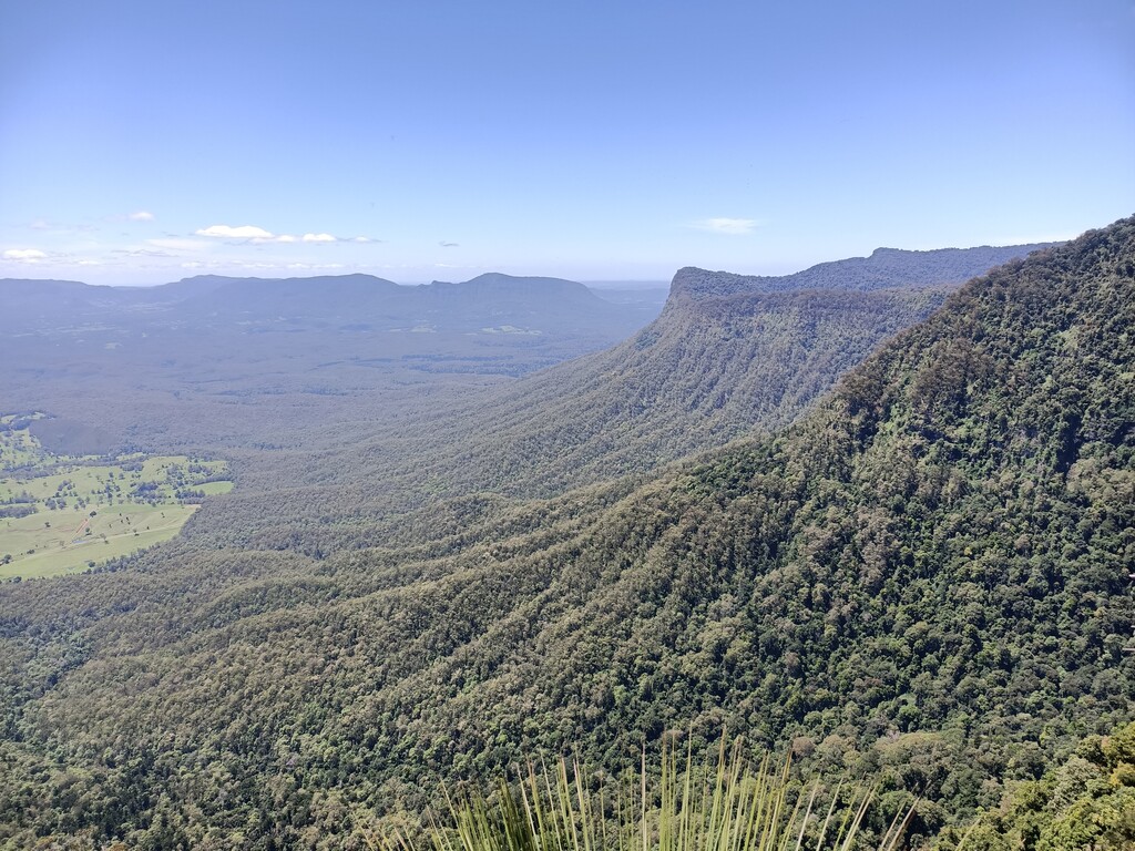
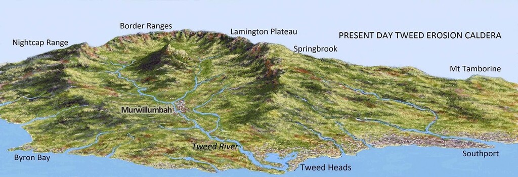
- Volcano : 23million year old/ largest erosion shield caldera in southern hemisphere.
- Knit together the National parks that I've trained in and loved for over 10 years.
- map a continuous track (previously never done) to provide a multi day trek on my doorstep.
- share the beauty of the caldera
- witness the central Volcanic plug Mt Warning/Wollumbin (1100m) from 360°
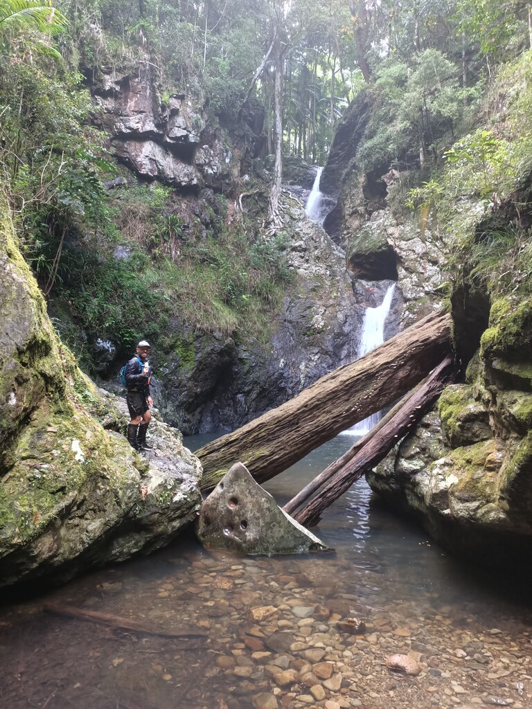
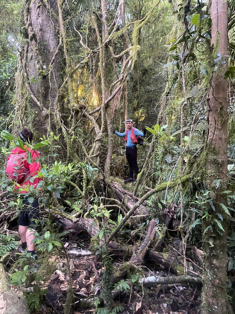
- rainforest /old disused logging roads/ single trail
- promote healthy living and access to nature to rural local town and villages (Murwillumbah, Nimbin, Byron Bay, Mullumbimby etc) in Northern NSW Australia.
Simon is currently setting up a Facebook page to promote the free sharing of resources/ maps and gpx files to support the above. It's very much been an obsession for over 10years, and Simon is happy he has proven it can be done in one hit!! (Or over multiple days)
The Full Tweed Volcanic Caldera Round:
"It's up to you..."
- STAY ON THE RIDGE/ CALDERA WALL / NO COMING INSIDE OF THE CALDERA WALL
- Between 250-270km /11,000m approx (gpx file bounced a lot in some places)
- Mixture of old logging tracks/ fire trail/ off trail/ some road
- Start and Finish : Murwillumbah Bridge (Tweed River : responsible for the erosion caldera)
- Circumnavigate the whole outer caldera that surrounds Wollumbin /Mount Warning central volcanic plug
- Anti-clockwise:
- Murwillumbar Bridge to Tomewin Rd - Garden of Eden - Cougals - Cream Track - Best of All Lookout - Springbrook - Numingbah Valley
- Numingah Valley - Bushrangers Caves - O'Reillys Track - Point Lookout (Stinson connectinon) - Lost World - Brindle Creek Rd
- Brindle Creek Road - Pinnacle Lookout - Bar Mountain - Lillian Rock - Mount Burrell
- Mount Burrell - Sphinx Rock - Mount Nardi
- Mount Nardi - Nightcap Bluff - Mount Jerusalem - Hughes Track - (Hell Holes Carpark)
- Hughes Track - Mt Chowan - Mooball National Park
- Mooball NP - Wardrop Valley - Murwillumbar Bridge (FINISH)