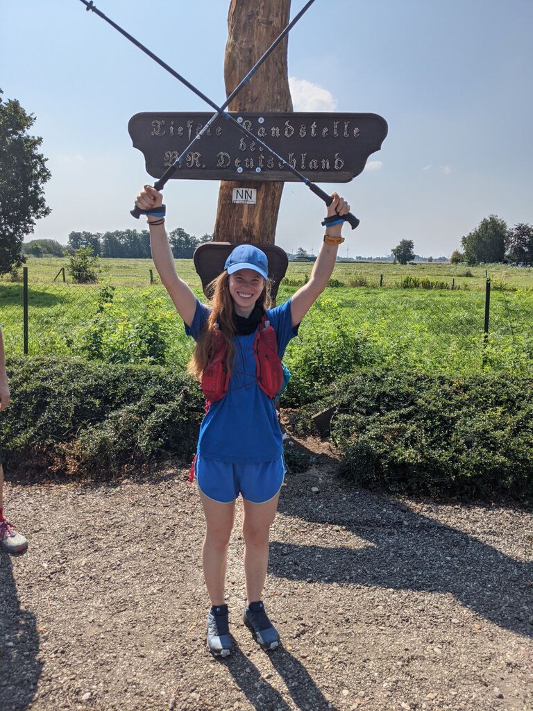
From Lowest To Highest (FLTH, Germany Edition) connects the two aforementioned topographical features to one another via a nearly 1000KM long route. This route begins somewhere 70KM north of Hamburg, in the middle of nowhere at a flat, unassuming, fenced off patch of land marked as "Lowpoint of Germany". Don't expect anything but starting line ... Read more
From Lowest To Highest (FLTH, Germany Edition) connects the two aforementioned topographical features to one another via a nearly 1000KM long route. This route begins somewhere 70KM north of Hamburg, in the middle of nowhere at a flat, unassuming, fenced off patch of land marked as "Lowpoint of Germany". Don't expect anything but starting line thrills here, because the flatness itself is as uninspiring as it is obvious. After setting off on your adventure to run across German, you will soon be passing along not just Germany's, but one of the largest rivers in Centra Europe: the Elbe river (https://en.wikipedia.org/wiki/Elbe). A quick ferry crossing is necessary just outside central Hamburg, a port city famous for its port (obviously), red light district (The "Reeperbahn") and Elbphilharmonics, to avoid detour off the FLTH route and highway traffic along the crossing bridges. It is the only motorized section required to be taken on this route.
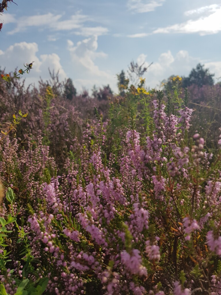
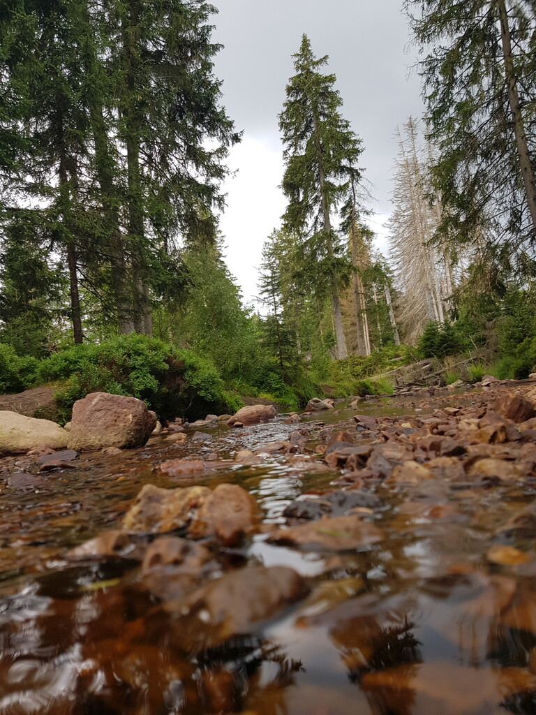
From Hamburg on, the sandy hills covered in heather are a treat for the tired eyes. The Lüneburger Heide is a magnificient national park full of blooming heather when passed through in August (https://en.wikipedia.org/wiki/L%C3%BCneburg_Heath). Linked to this national park in close succession is another: the Harz (https://en.wikipedia.org/wiki/Harz_National_Park). This section includes the first test for the quads, by providing an underwhelming 810m of vert for the trained mountain runner(or an overwhelming 810m of vert for the flatland enthusiast). The section passes by in line of sight of the Brocken (https://en.wikipedia.org/wiki/Brocken), the highest peak of this northern mountain range.
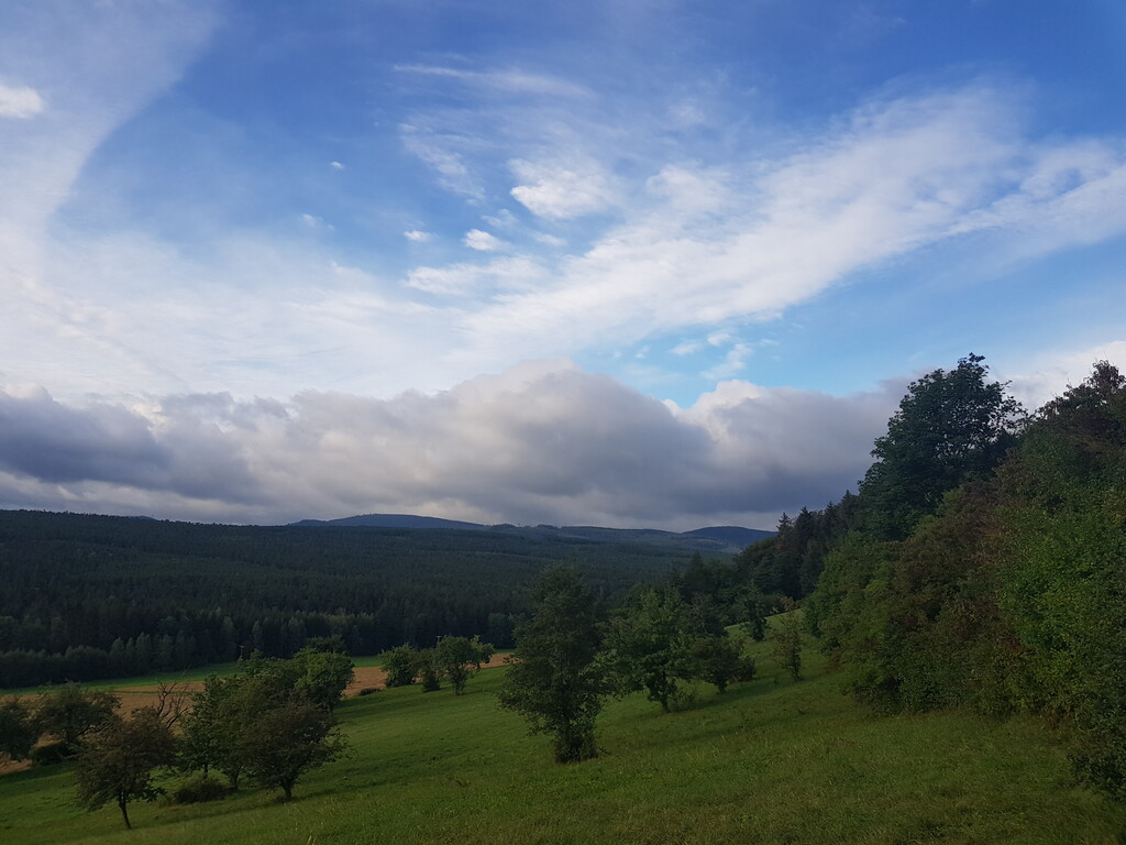
Past this point, any FLTH runner will soon march on into Thüringen, and encounter the Rennsteig (https://en.wikipedia.org/wiki/Rennsteig). This 170KM long trail (FLTH runs along a majority of its trails) was first mentioned in 1330, and is one of the most famous trails of the German midlands. It is surprisingly beautiful, and especially bird life seem to have taken a fancy to the area. Warning for all "Unsupported" runners hoping to sleep in the wooden huts along some field edges: these tend to be locked and/or of low-quality in this area. A Bivy is highly recommended.
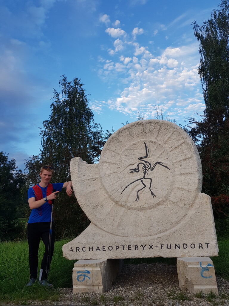
When you've passed through the Rennsteig, you will soon cross into Bavaria. The route passes by big(ger) cities like Coburg, Nürnberg and Augsbug, and smaller ones like (Solnhofen (discovery site of the archaeopteryx for all you rock nerds https://en.wikipedia.org/wiki/Archaeopteryx#History_of_discovery). This section also runs mainly along the channels connecting major rivers (Main, Donau) and minor rivers (Lech). If you wander into town in Augsburg for a rest, it's worth stopping by the famous Augsburger Puppenkiste (https://en.wikipedia.org/wiki/Augsburger_Puppenkiste). I'm not old enough to really understand WHY it's so famous, but the town is cute, so it's worth a wander in my books. The water of the Lech, which runs along the FLTH route, is a blue, icy gem of a river, and a wonderful remedy for swollen feet.
If you have made it this far, the mountain peaks of the Alps should slowly be creeping into your view. Be careful when crossing through the very muddy, and treacherously slippery canyon winding its way along the Ammer (https://www.pfaffen-winkel.de/natur-erleben/die-schoensten-wanderwege-im-bereich-der-ammerschlucht/ or https://de.wikipedia.org/wiki/Ammerschlucht). DO NOT GO DOWN IN THE DARK WITHOUT A FUNCTIONING FLASHLIGHT. There is no place to bivy in the canyon. Rest either before or after this section.
Once through the canyon, you've made it safely into the next national park (FLTH is essentially just a string of national parks, one behind the other). This one will be your the second-to-last one:https://en.wikipedia.org/wiki/Ammergau_Alps. The run takes you through Oberammergau (https://en.wikipedia.org/wiki/Oberammergau), wildly famous (so I heard on a podcast during my run) for its 380-year long tradition of over-the-top production of the Passion Plays. Most inhabitants of the village are somehow involved in the putting on the play, so I've heard (here: https://podcasts.apple.com/de/podcast/far-flung-with-saleem-reshamwala/id1514010062?l=en&i=1000480884526).
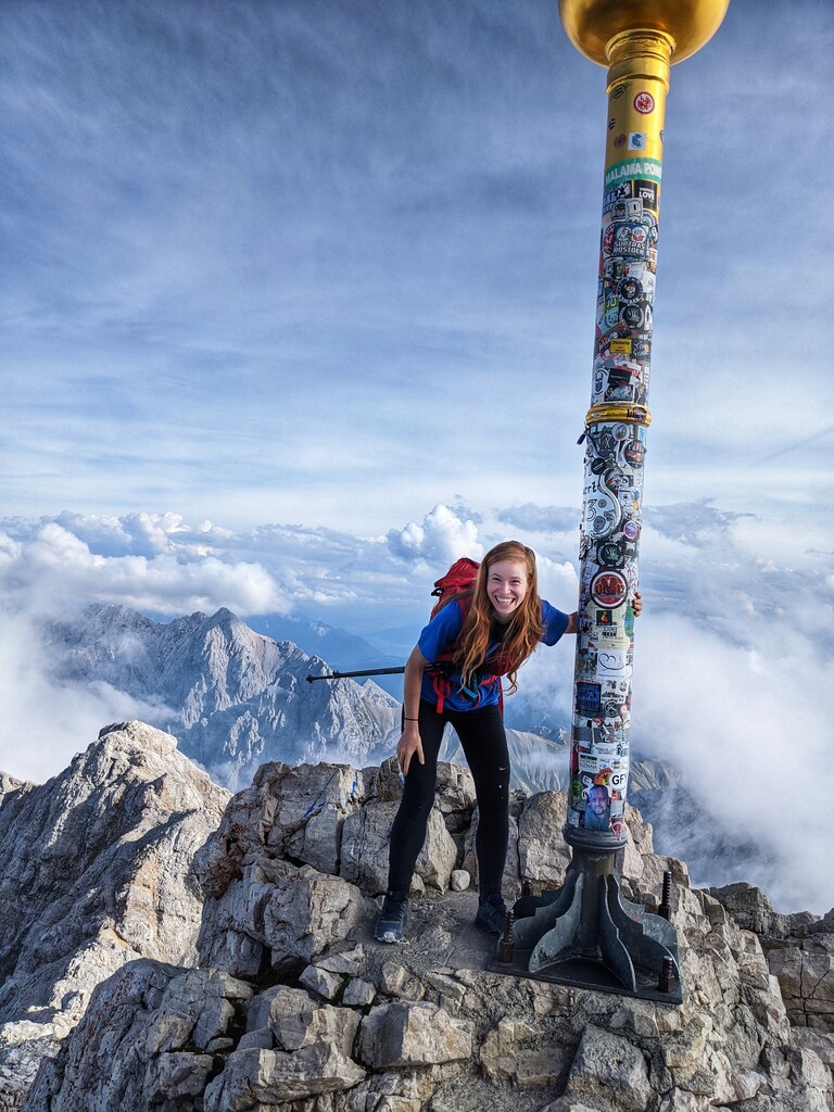
Finally, make your way to Garmisch-Partenkirchen. A rest is highly recommended before your final ascent of the highest point of Germany. The route recommended for trail runners is the "Reintal-Zustieg" (https://bergsteiger.de/touren/wandern/durchs-reintal-auf-die-zugspitze in German, https://www.outdooractive.com/en/route/mountain-hike/zugspitz-region/on-the-heels-of-the-pioneers-through-the-reintal-to-the-zugspitze/1398682/ in English). It requires sturdy footwear, and the ability to deal with debilitating vert at the end of your nearly 1000KM run. Adrenaline should get you to the top, but just to be on the safe side, pack snacks and water, too. Most vertical meters are packed into the last 5K of the route, which also includes a disasterously steep moraine consisting of nothing but gravel and tourist's tears (it will soon most likely aslo contain your own). But once you've made it to the top, it is time to celebrate. Surrounded by idling tourists, most of whom will have gotten to the top via cable car, you will have finished From Lowest To Highest (Germany Edition) by standing on the Zugspitze, the highesst point of Germany (https://zugspitze.de/en).
And I sincerely hope you checked the timetable for when the last cable car will take you down the easy way, because otherwise: congrats on being forced to add another 20KM to the run. Whatever may happen post-run: no one can take the fact that you MADE IT (!!!) away from you.
Read less