Bells Gap Trail:
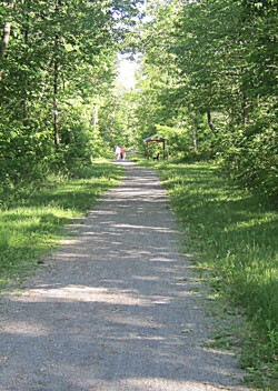
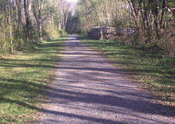
There’s more than one way to climb the Allegheny Front! The Bells Gap Trail follows a meandering right-of-way that enabled the Bells Gap Railroad to climb the Front on a grade of 4% or less as early as the 1850s. Today the 6.3-mile trail provides some outstanding views of eastern ridges, the Tuckahoe Valley and Bellwood Reservoir while crossing pretty little mountain streams before ending its climb in Lloydsville.
Trail Description:
At four percent, the Bells Gap Trail provides a moderately challenging but beautiful hike/run. After leaving the trailhead just north of Bellwood Borough, the trail parallels Route 865 and passes the scenic Bellwood Reservoir. After 2.1 miles, the tree-lined crushed limestone surface ends, but the trail extends for another 4.2 miles on Pennsylvania State Game Land access road that tends to be packed dirt, with a grassy median and occasional gravel fill. The Bells Gap Trail terminates in the village of Lloydsville at the top of Blandburg Mountain, but there’s no trailhead there.
Challenges:
- Bells Gap Trail climbs through a gap in the Allegheny Front at a grade of no more than 4%.
- The PA Game Lands access road is unimproved and occasionally provides a rougher riding surface.
- With only one trailhead, Bells Gap Trail offers an out-and-back ride of 12.6 miles.
As the description says its rail trail for 2.1 miles then it becomes grassy and then gravely once near the other end. Your going up hill basically the entire time on your way out, which is nice because its all downhill on the way back, except for a few feet. This is an easy to navigate trail, you just follow the worn path. It's not straight it does wrap around the mountains but still easy to follow. Pretty scenic. I will say mid summer the grass in some spots can get waist high, which means you have wade thru it. Those section I tend to kick deer out of. You can see all the normal wildlife as well including bear and snakes. Most people don´t travel past the rail trail part. There is some benches and overlooks where you can sit and see views along the trail. A couple are past the rail trail part. In the past there was no mile markers. Just have to go by information on your watch. Near the other end where it opens up away from the mountain sides you will pass an acid mine drainage site. The trail does have nice shade in the summer so the sun is not beating down on you during those hot days.
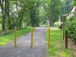
This is a full out and back FKT. You start at the trailhead parking lot. Put a hand on the yellow trail dividers in the middle of the trail where the parking lot meets the trail (pic). That is the start of the FKT. The turn around will be 6.3 miles up the trail. The turn around point is the Brown Game commission gate. Place a hand on it before turning around. You will be able to see a road about 20 yards beyond the gate. To finish place you hand on the yellow trail dividers you touched when you started. You should get around 1,000 feet of gain and 12.6 miles. Depending on your watch you could have 100 feet of gain difference but mile should be 12.6.
There usually is a portajohn in the parking lot.
Here is a link to the trail
http://www.transalleghenytrails.com/trails/bells-gap-trail.aspx
This is a video of the whole trail on the way out i took
https://www.youtube.com/watch?v=wJQgAfj_D0g&t=19s