This 384-acre natural area is located at the western end of the Rager Mountain Forest Area near Cramer in Indiana County.
The Charles F. Lewis Natural Area is located in a small section of the Galitzin State Forest located along the Conemaugh River, spanning the Indiana /Cambria county line. Named for a newspaperman and the first president of the Western Pennsylvania Conservancy, this natural area is located just across the river from the northern terminus of the Laurel Highlands Hiking Trail.
This wildlife area does not get much use. Mainly because of the difficulty of the trail for local residents. Its got a great mix of surfaces and terrain. If you are driving too fast on route 403 you will miss the parking lot. Its not huge and only holds a few cars at a time. There is no signage alerting you that its coming up from either direction. Its also right around a curve in the road hiding it even more, so make sure you put turn signals on early.
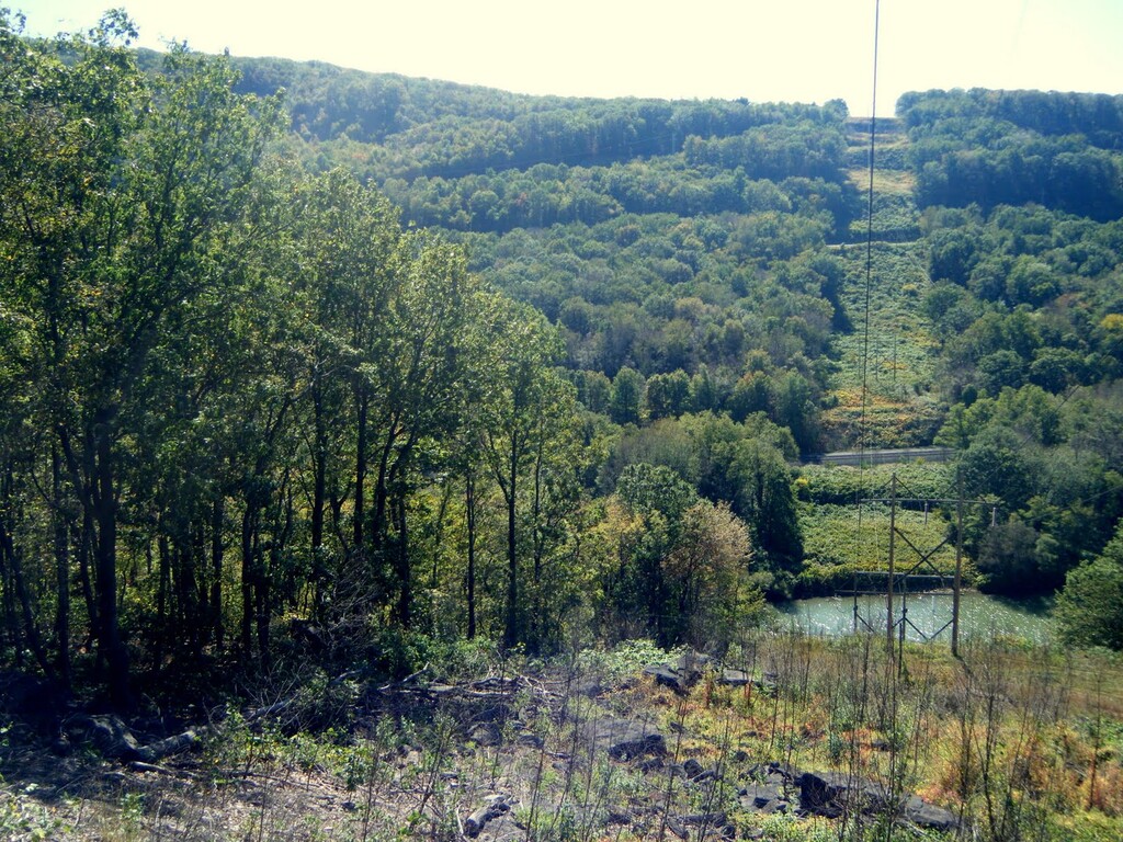
This route is to be done counterclockwise on the outer main 5 mile loop. To officially start you must be touching with you hand one of the big boulders in the parking lot this touching of the boulders is also the way to stop the route, try to use the one that is directly inline with the trail itself. You want to follow the Ranger Mountain Trail route. From the parking lot its only flat for like a tenth before its becomes a rocky single track for about .7 miles which is uphill along a nice scenic very small creekbed. Then you head uphill from there on easier Rager Moutntian trail path. Its does become a wide trail for a bit in the steep part before popping out onto a powerline. This powerline is directly across from the Laurel Highlands Hiking Trail powerline you cross with 1.5 mile in form the Seward Trailhead.
Be careful not to miss the marking where to enter the woods. Once entering the woods the next half mile to mile is the easiest and flatest part. It has some nice rock features along the trail. Its is grassy though. So in the summer months you have to be careful because the grass overruns the trail due to low usage. You will encounter some up and downs for a while. You do cross another power line at one point and a nice open area where you get a glimpse of the powerplant in Seward. This is all on single track that can get rooty at times. After the openness of the powerplant you will encounter patches of the trail where Jagger bushes pinch the trail in the summer so pants or high socks are recommended. Good news is you are declining. There is also a section that has been timbered but not clear cut 2 years ago so be careful because the trail in that tenth to 2 tenth section is hard to read with some of the trail marking trees cut down. After the timebered section you do get into some more runnable trail for a couple tenths.
Then comes a really hard rocky section. There are big bouldery ricks that are not really runnable at all so it will slow you down a ton. You will have to jump and climb over some. Just be careful of you footing. Also snakes yes there are rattlesnakes in this section and you wont know they are there until you are basically on top of them if your running. Just be mindful. After the rocks is really when you start to decline back down. As your climbing back down there is a little side trail like 100 feet you can take that has a really nice overlook of the valley or you can go off trail to the right and hit the powerline for another great view. As you turnback onto the moutain for the last half mile because this is another rocky section but there are more pesky rocks because they are not constant. Once you step off one you have a couple feet before the next so you cant get any momentum going.
Once you hit the bottom of the trail you come to a creek crossing which you must take to get back across to the start of the trail which is on the other side. That is one of the reasons we go counter clockwise so the creek crossing is at the end so you feet are not wet the entire time. Though that depends on how high it is. If its high you cant get across without getting wet. But if its lot there are some rocks in place you can step on to get across without getting wet. At the end though your going be all sweaty so it really does not matter anyhow is feet get wet then. Then just follow the trail back out to the parking lot that last two tenths and touch the same boulder you did to start the FKT.
Now this trail is hard to explain which I tried to do so, its still vague because of how hard it really is to describe. You do have yellow blazes to follow. The blazes have improved over the last year. They used to be nonexistent. Its hilly, rocky, single track double track, grassy, throny and so forth all mixed into a 5 miles of trail. There are 5 trail markers along the trail but they are a little off. What also makes this a challenges trail and fkt is the wildlife there are rattlesnakes, ground bees, bears, deer, porcupines ect.. that you may encounter. So always be on the lookout. Also watch your footing in the high grass in the summer months. If you goign to do this id so it in early spring of late fall. Summer alot more critters out. Its also open to hunting so if hunting season is in wear orange. Its a natural area so the DCNR does not take care of it much.
Last summer I did video the 5 miles so people can see everything beforehand. Even while videoing i did step on some bees which if you pay attention enough to the video you can tell when it happened. The video can be found at https://www.youtube.com/watch?v=-IC6LZZ4gxo
The last thing i will say it is a 5 mile loop. My watch though gives me at least 1,200 feet of gain. Sometimes more because services is bad there and the way the trail is set up sometimes the sat pings dont get all the data. Your watch can gt 4.8 miles to 5.2 miles with 1,200 up to 1,500 feet of gain. So you must show at least 4.8 and 1,200 to claim it. There is no way to course cut so your map file will show if you really did complete it or not.
Other links about the trail
https://pahikes.com/blogs/gallitzin-state-forest/exploring-the-charles-lewis-natural-area
https://www.alltrails.com/explore/recording/charles-f-lewis-natural-area--2