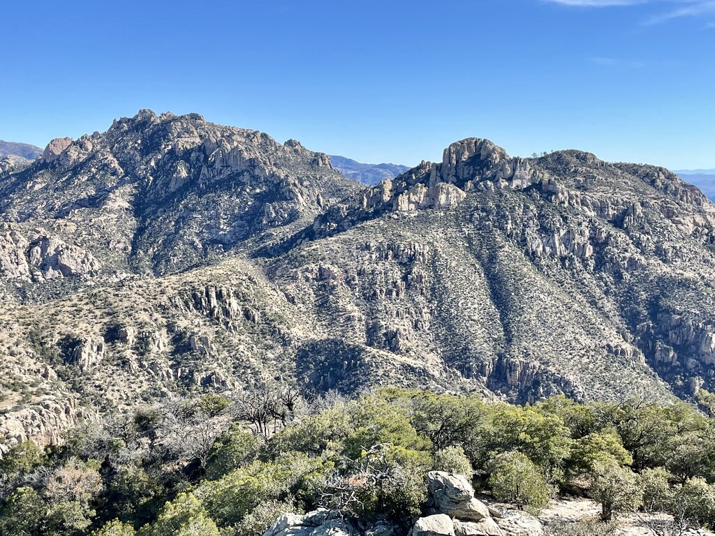
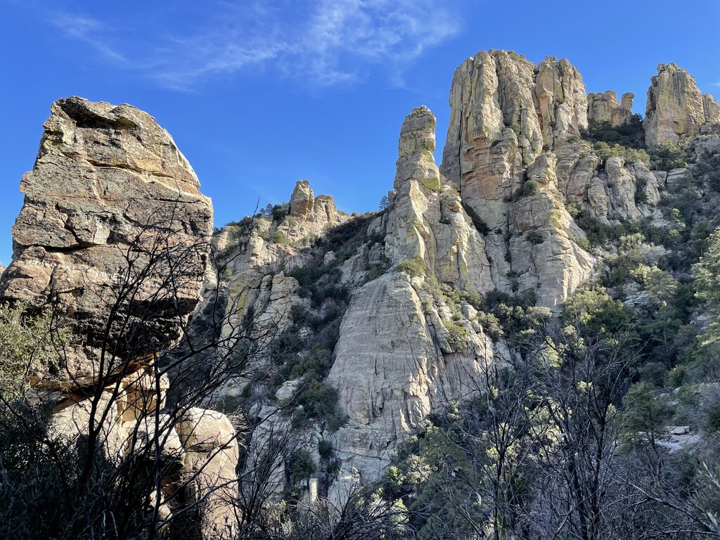
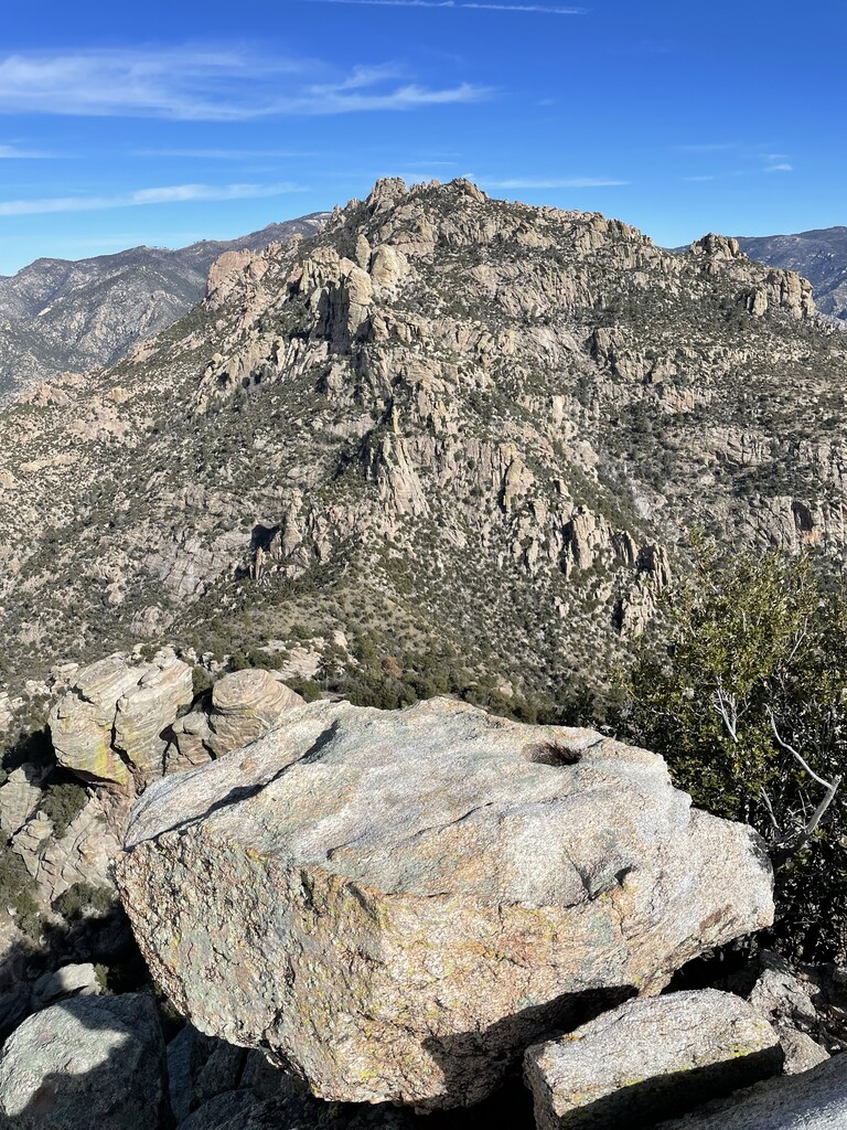
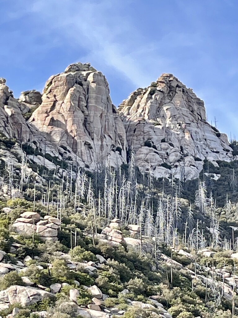
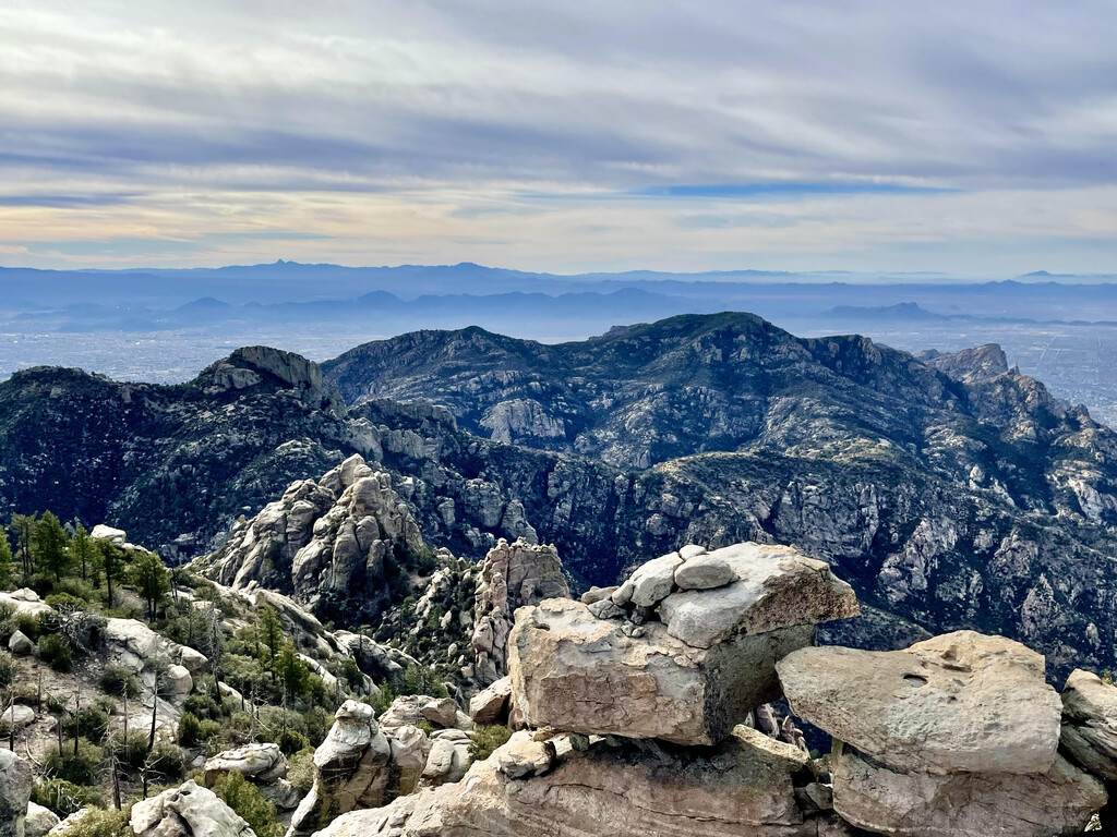
This route climbs to the summit of the three highest peaks in the front range of the Santa Catalina Mountains - originally known to the Tohono O’odham Nation as Babad Do’ag - which is the iconic skyline one sees when looking north from Tucson. The route is best climbed west to east, ticking the easiest peak first, Mt. Kimball (7258 ft), before moving on to Window Peak (7456 ft) and finishing atop Cathedral Rock (7952 ft). While Kimball’s summit has a trail all the way to the top, Window requires a couple hundred meters of off trail navigating and an unexposed class 3 scramble. And the crown jewel of the front range, Cathedral, has a mile of solid bushwhacking before a rope assisted 5th class gully and an exposed 3rd class move up the summit block. In this sequence, the first two peaks serve as a test piece for the one that follows. Climbers will ascend roughly 8000 feet over 12.5 miles.
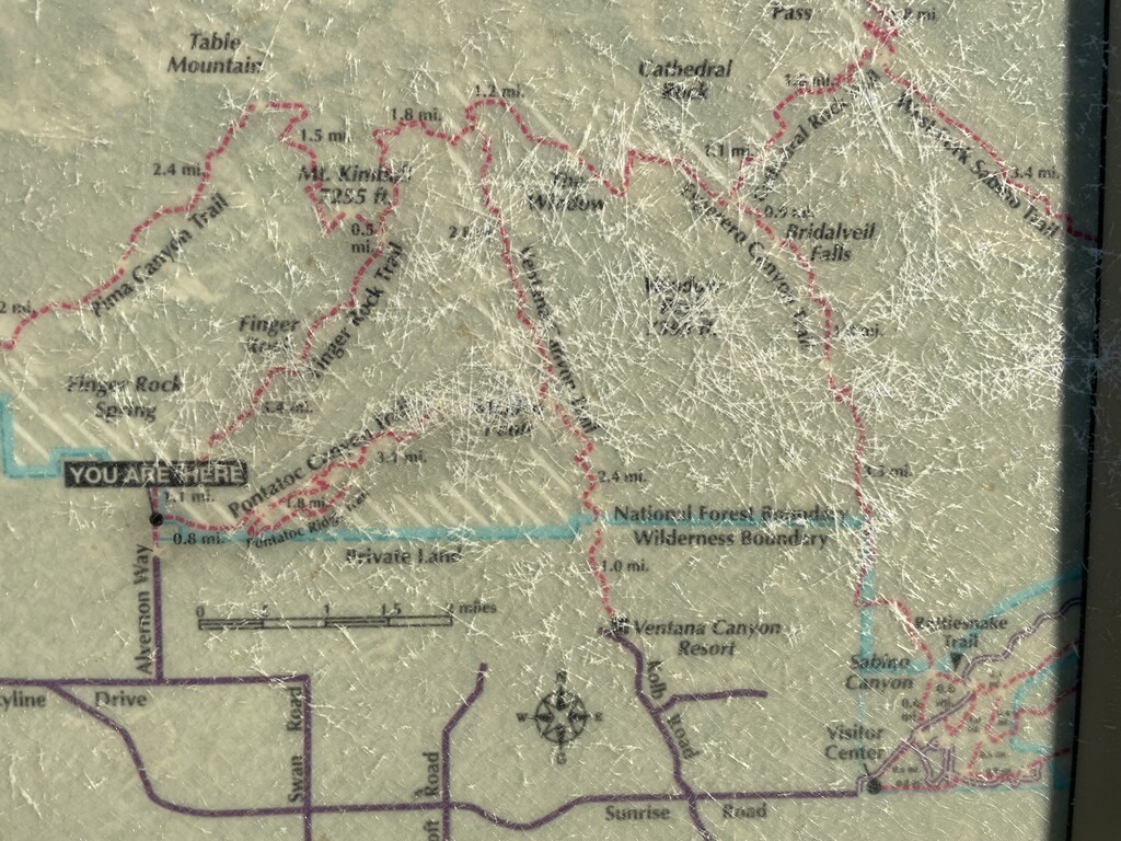
Starting at the Finger Rock trailhead, the route begins moderately but becomes sharply steeper after 1 mile on Finger Rock trail #42 to the Pima Canyon #62 trail and spur to Mt Kimball (4.7 miles total). It then backtracks .6 miles to Finger Rock trail, where climbers continue on to the Esperero junction (Finger Rock #42, Ventana #98, and Esperero #25 trails all meet here), and beyond to “The Window,” a large natural arch and one of Tucson’s best vistas. Window Peak is not far from the arch and the short bushwhack begins by turning left and heading uphill at the saddle, the best line curving to the right around some rock formations. A few minutes of tree assisted 3rd class scrambling later and you’re at the Window Peak summit (8.6 miles total), with a great view of the rounded Kimball to the west and craggy Cathedral to the northeast. After retracing their line back to Esperero trail, climbers continue 1.5 miles to Cathedral Rock Trail #26, turning left/uphill to reach the saddle 1 mile further on. This is where the extensive bushwhack begins. Multiple cairned pathways lead to the summit, but they all converge on the upper platform where a fixed rope leads up a steep 40-foot 5th class gully. The summit block is finally achieved with an exposed 3rd class move. This completes the “Front Range Triple,” but climbers must still descend the sketchy parts down Cathedral and backtrack their bushwhack to the Cathedral Rock trail. From here, the fastest retreat is back to Esperero trail and down to Sabino Canyon Recreation Area (21 miles in total), though some may choose the more scenic/longer option down the West Fork trail to Sabino Canyon, which adds 5-6 miles to the descent, but includes a stretch of the AZT, Hutch's Pool, and more runnable terrain.
The trail between these three peaks was recently cleared, creating an opportunity to link them more easily than at any point in the last decade. Due to a bighorn sheep management closure by the USFS, the Pusch Ridge Wilderness surrounding the three peaks limits users to within 400 feet of established trails between Dec 1 and April 30, making Cathedral Rock very much off limits during these dates. It should also be noted that water is nowhere to be found on this route. Overall, this is a phenomenal line traversing the three highest peaks in the Santa Catalina Mountains' front range, with challenging ascents and varying terrains, offering climbers a unique and authentic wilderness adventure.
Comments
Correction on the route above, the bighorn sheep closure in the Pusch Ridge Wilderness begins January 1, not December 1, and runs through April 30. https://www.fs.usda.gov/recarea/coronado/recreation/recarea/?recid=2569….