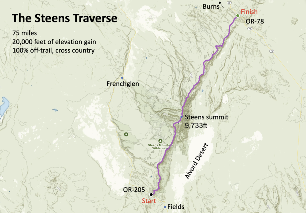
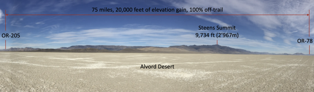
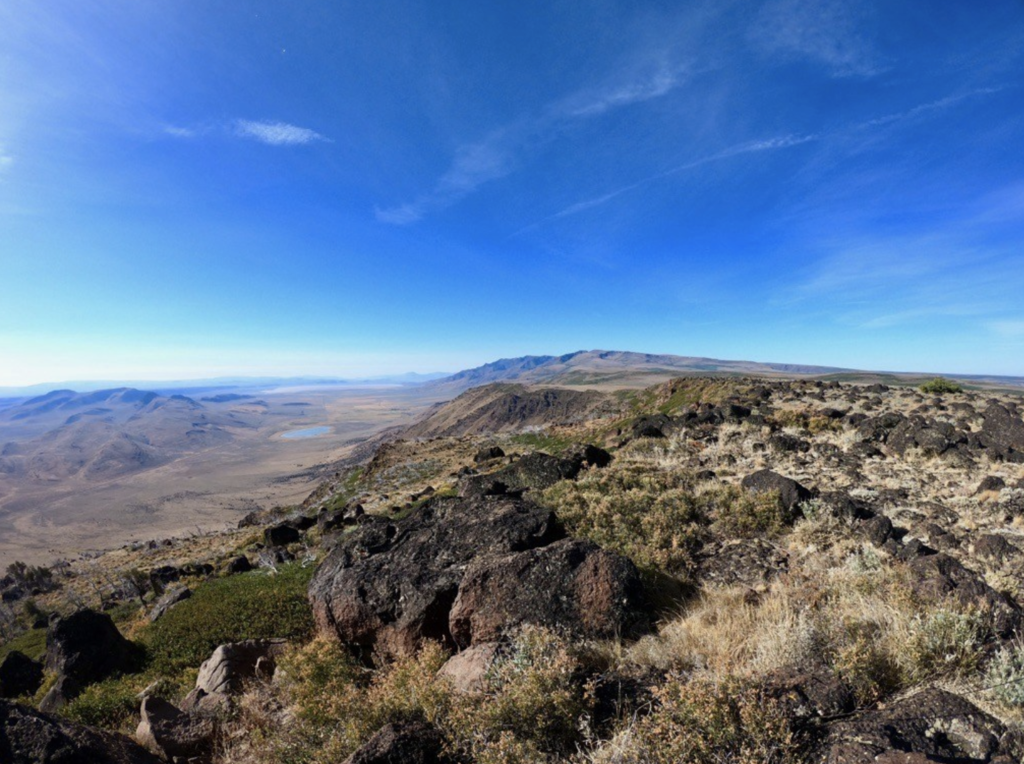
Steens Mountain is one of Oregon’s great scenic and geological wonders, a 30mi long fault-block with a spectacular and rugged east face that rises one vertical mile above the equally spectacular Alvord Desert. Steens Mountain is the largest fault-block mountain in the northern Great Basin. A 59mi (95km) loop road, the highest road in Oregon, scales the mountain range and tops out at 9,734ft (2’967m). The Steens also offer some of the most impressive fall colors and are home to the toughest 10k in Oregon.
The (real, or long or North-South or South-North) Steens Traverse challenge consists of traversing the entire mountain range from North to South (or South to North) between OR-78 (43.10004, -118.23641) and OR-205, the Higher Desert Discovery Scenic Byway/Catlow Valley Rd. (42.31616, -118.74916) The approximately 75 mile long route entirely follows the fault-block’s rim, offers stunning views, is 100% off-trail, rugged, wild, slow, and unique in every aspect. The traverse can be completed on public (BLM and state) land only, although that involves a few "detours." Please respect private land and ask for permission to pass if necessary. You can start on either end and go either southwards or northwards.
The rim is rugged, exposed, and unforgiving. The weather can change quickly and dramatically as you climb toward the highpoint (9,734ft). It can snow in the middle of the summer. Help may be far away and water is hard to find. There are also several tricky technical parts. If you attempt this, do your homework and come prepared.
The GPS file does not indicate a feasible and safe route. It merely follows the rim and indicates the general direction.
More info about this challenge at https://www.christofteuscher.com/aagaa/steens-traverse