The route begins at the Taylor Bay trailhead and follow the Tutka Backdoor Trail, Tutka Falls Trail, and Tutka Lagoon Trail to finish at Jakolof Bay. Total distance is 50k+, with around 9,000 feet of elevation gain spread across four major climbs. This is a run for those who want an epic experience. There is one major river crossing and three minor ones, as well as several creeks to cross, and a tidal lagoon to skirt. Parts of the route are marked only by cairns, and the trail is both steep and rugged. Most of the distance is in alpine tundra, rocks, and subalpine meadows, with lower elevation sections in old-growth spruce forest. The views are amazing. The trail is longer than any other trail in Kachemak Bay State Park.
Route Description
Start - Taylor Bay Trailhead to Taylor River (0-5 miles)
Trail climbs steeply through the forest from the Taylor Bay trailhead, popping out into
alpine meadows at around a mile. Cairns mark the way through alpine tundra to a steep
scree field, where the trail traverses up to Heart Lake Pass at 1,600 feet. Trail descends
through alpine and subalpine meadows to the forested floor of the Taylor River Valley.
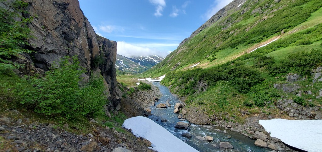
Taylor River
The Taylor is a large glacial river, and the most difficult ford on the route. Large cairns
mark the best crossing point, angling upstream to end just above a tributary entrance on
the far side. Rainfall or snowmelt can render the crossing hazardous. Racers should use
their own judgement and consider using a stick or trekking pole for aid. A volunteer will
be stationed on the far side with a packraft — racers can signal for a ride if they feel the
crossing is unsafe.
Taylor River to the High Traverse (5-6.5 miles)
Trail climbs steeply to follow a rocky shelf at 1,900 feet of elevation. Cairns mark the
alpine portion of the route. Runners may need to cross small remnant snow patches.
High Traverse to Tutka Pass (6.5-10.5 miles)
Trail descends steeply along a rocky nose, then begins to contour the valley. After a
narrow point, trail opens to a broad gravel/rock valley that climbs to Tutka Pass. This is
the least-marked section, with only a few large cairns. It is also the easiest navigation —
with almost no vegetation in the valley. At the head of the valley, more closely spaced
cairns lead up to Tutka Pass.
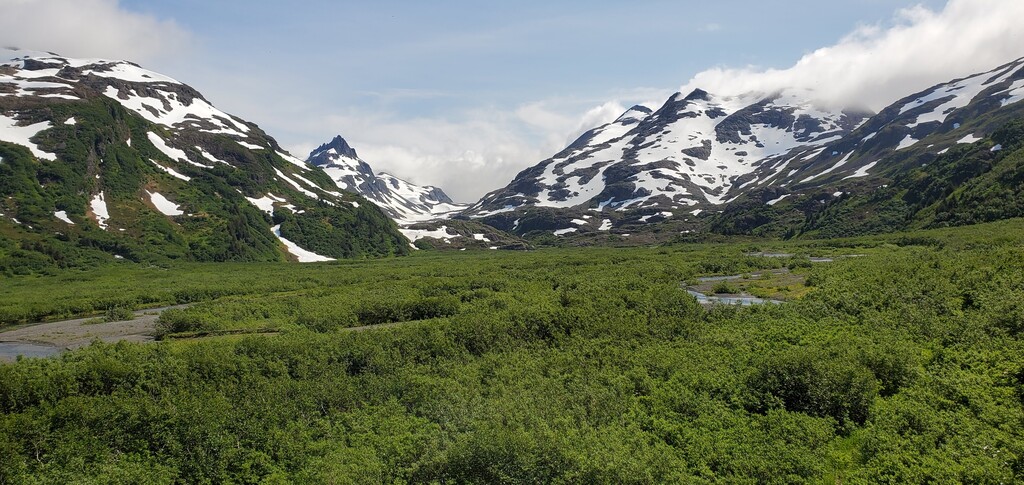
Tutka Pass to Lunch Mountain (10.5-15 miles)
A short way down the pass a nice band of tread begins on the left side of the valley. Trail
descends to a broad alpine rocky valley, then traverses a boulder field at the “choke
point” and opens out onto an even larger tundra valley. Cairns lead the way to a crossing
of the Upper Tutka River, just above the confluence with Impossible Creek. Trail follows
the right side of the valley for a while, before crossing again, and then remains on the left
side thereafter. Dropping down from the Tundra Playground, trail heads through a
willow-filled valley, before climbing briefly to traverse another narrow choke point.
Follow rolling terrain through sub-alpine meadows to the swimming lake, then climb to
Lunch Mountain.
Lunch Mountain to Tutka Bay Camp (15-20.6 miles)
Trail drops steeply to the river valley, crossing a small tributary that is sometimes filled
with salmon. Then the trail levels out, roughly following the river valley and cutting
around the tide flats, to end at the camp at the head of Tutka Bay. A volunteer will be at
this camp with supplies and a skiff, for anyone who wants or needs to bail here. There
will be a cutoff time of 10pm to reach this checkpoint.
Tutka Bay Camp to Sentinel Ridge (20.6-24.3 miles)
Climb again steeply, up to Sentinel Ridge at around 2000 feet. The last major climb.
Sentinel Ridge is the only spot on the route with semi-reliable cell service.
Sentinel Ridge to Tutka Lake (24.3-28.8 miles)
Trail drops steeply, then levels out in the forest, meeting up with the old end of the Tutka
Falls trail, skirting Tutka Lake and on to Tutka Lagoon Hatchery.
Tutka Hatchery to Jakolof Bay Road (28.8-31.5 miles)
Follow the coastline around to the back of the lagoon, crossing Tutka Creek at the mouth.
This is easiest if the tide is below 13 or 14 feet. If it is higher, runners will have to get
wet, bushwhack, or wait. At the back of the lagoon, a trail heads over a low forested ridge
before coming out into logged areas on SNA land, where the trail will take you to the
main road.
Jakolof Bay Road to Jakolof Campsite (31.5-34.4 miles)
2.5 miles of gravel road to the campsite near Jakolof dock is the finish line.