Overview
Many of West Hartford’s public parks and woodlands are hidden in plain sight. Most are located near vibrant downtown centers, accessible and valued green and blue spaces in a highly developed town.
This route provides a remarkable contrast between the built environment of a large suburb (roads, bridges, buildings, etc.) with natural elements (forests, waterways, meadows, etc.) as it purposely weaves through five downtown neighborhoods. Those neighborhoods - Bishop’s Corner, Elmwood, Park Road, West Hartford Center and the Reservoir area – all have distinct vibes, pleasing designs, intriguing artwork, attractive architecture, curious historic sites and plenty of amenities.
The route passes many schools, community centers and transit stations to encourage people to explore more locally. Aromas from local restaurants, the hum of busy roads and alluring storefronts give way to solace; smells of fallen pine needles, sounds of leaves cracking underfoot and sights of changing fall colors. A surprising number of natural and wild places can be enjoyed in this town of 63,000 people.
Route
This 24.2-mile route is connected by a mix of pedestrian paths, trails, designated bike routes and roads with shared bike lanes. It purposely passes through each downtown area to show how green and blue spaces are closer than they might otherwise appear. The public parks and woodlands are owned by a mix of the Town of West Hartford, Metropolitan District Commission (MDC), West Hartford Land Trust, and Holy Family Retreat Center.
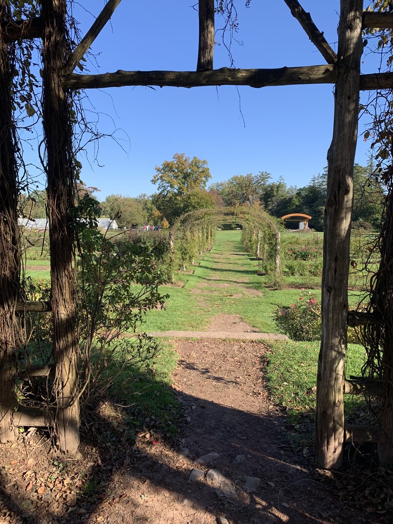
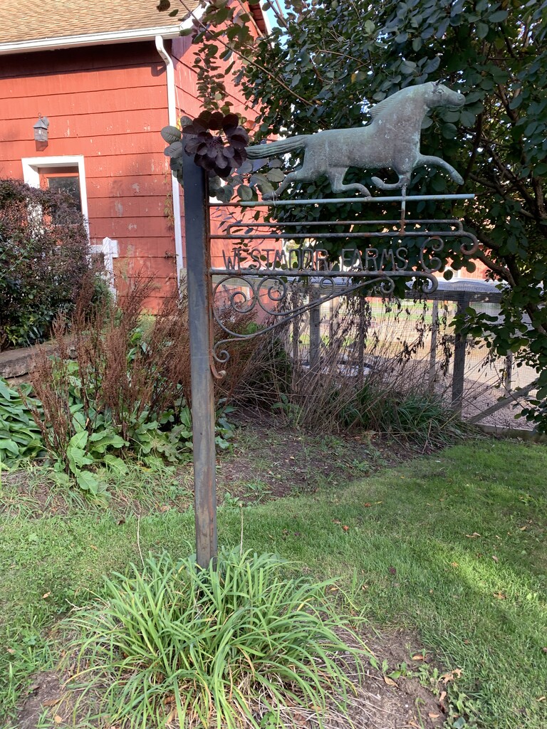
The route begins on the steps of the Gazebo in the Rose Garden at Elizabeth Park and ends at Westmoor Park. Upon completion, be sure to fist bump the front hoof of the horse on the wrought iron Westmoor Farms sign at the red barn!
Start - Elizabeth Park, 1561 Asylum Avenue (Notes: iconic rose garden, outdoor summer concerts, full service restaurant)
Begin at the Gazebo in the Rose Garden. Follow Western Loop to intersection of Asylum Avenue and Steele Road (pass Beach Park) to N Steele Road to Ledyard Road (pass Hartford Golf Club) to Mohawk Drive. Cross North Main Street onto Whitehill Road to Karen Road to West Ridge Drive to Hartwell Road. Follow paved path past Hall High School ball fields. Continue on Hyde Road; arrive Eisenhower Park. Mileage: 3.91 miles from Elizabeth Park to Eisenhower Park.
Eisenhower Park, 33 Sheep Hill Drive (Notes: pool, basketball court, ball fields, playgrounds, beach volleyball, batting cage, restrooms, picnic tables)
Continue on Hyde Road to Alden Drive to Miller Road. Follow North Main Street to Bishop’s Corner. Continue to the intersection at Lawler Road. Follow Lawler Road to former UConn Property. Mileage: 1.81 miles from Eisenhower Park to former UConn property.
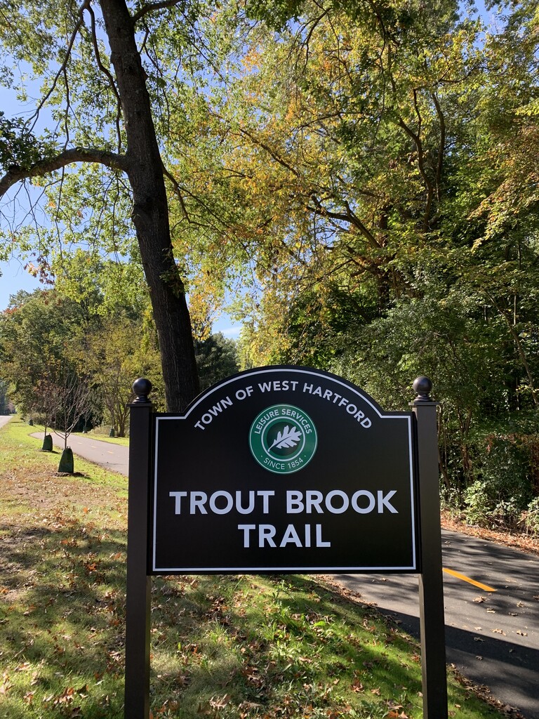
Former UConn Property, 1700 Asylum Avenue (Notes: current developer intends to extend the Trout Brook Trail through the property)
Continue on Trout Brook Trail. Cross intersection at Trout Brook Drive and Park Road. Follow Park Road to Oakwood Avenue. Arrive Kennedy Park. Mileage: 3.2 miles from former UConn property to Kennedy Park.
Kennedy Park, 160 Oakwood Avenue (Notes: pool with water slide, splash pad, basketball, tennis, ball fields)
Continue along Oakwood Avenue to Flatbush Avenue. Follow Flatbush Avenue (pass Sterling Field, Glover Soccer Park Complex) to Quaker Lane South (pass National Guard Readiness Center). At intersection of Quaker Lane South and Trout Brook Drive, continue on Trout Brook Trail along the Trout Brook waterway. Turn onto New Park Road, onto New Britain Avenue, back onto South Quaker Lane. Cross the street into Beachland Park. Mileage: 2.77 miles from Kennedy Park to Beachland Park.
Beachland Park, 847 South Quaker Lane (Notes: pool, splash pad, basketball, ball fields, pond, trails)
Depart Beachland Park on Blue Bike Route to Mayflower Street. Turn onto New Britain Avenue. Cross New Britain Avenue to Wolcott Park. Mileage: 1.13 miles from Beachland Park to Wolcott Park.
Wolcott Park, 1314 New Britain Avenue (Notes: splash pad, tennis, pickleball, ball fields, community gardens, pond, trails)
Follow Wolcott Road to Davenport Road. At end of cul-de-sac, arrive at Wojan’s Woods. Mileage: 0.6 miles from Wolcott Park to Wojan’s Woods.
Wojan's Woods, next to 151 Davenport Road (Notes: woodlands, trails)
Follow trail into Wojan’s Woods to Red Top Drive. Follow Red Top Drive to Burnham Drive into Corbin’s Collection. Cross New Britain Avenue onto Ridgewood Drive. Continue onto Woodpond Road to Ridgeview Drive to Woodruff Road. Arrive at Holy Family Retreat Center side gate. Mileage: 2 miles from Wojan’s Woods to Holy Family Retreat Center.
Holy Family Retreat Center, 303 Tunxis Avenue (Notes: labyrinth, trails)
Follow Tunxis Road to Brookmoor Road to Cornerstone Drive. Arrive Buena Vista Recreation Area. Mileage: 1.4 miles from Holy Family Retreat Center to Buena Vista Recreation Area.
Cornerstone Recreation Area, Cornerstone Road (Notes: Cornerstone Aquatics Center, Veterans Skating Rink, 9-hole Buena Vista Golf Course; tennis, pickleball, community gardens)
Continue up Buena Vista Road. Cross onto West Hartford Reservoir #1 grassy area. Arrive at West Hartford Reservoir #1. Mileage: 0.5 miles from Buena Vista Recreation Area to Reservoir #1.
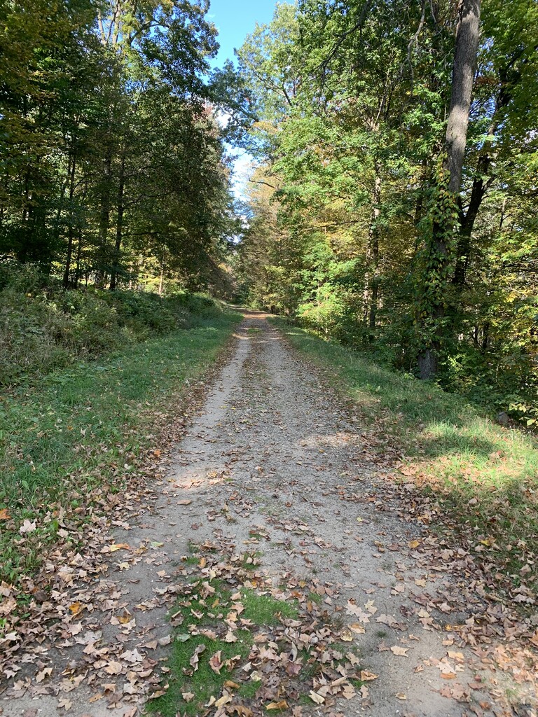
Reservoir #1, across from 158 Buena Vista Road (Notes: 3,000 acres of woodlands, 30 miles of paved, dirt and gravel trails and intersects with both the Talcott Mountain State Park and Metacomet Trail networks.)
Continue on Farmington Avenue to Mountain Road. Arrive at Spicebush Swamp. Mileage: 1 mile from Reservoir #1 to Spicebush Swamp.
Spicebush Swamp, 173 Mountain Road (Notes: bird sanctuary, pond for fishing, trails)
Cross onto Gloucester Lane. Bear left onto wooden bridge onto Walton Drive cul-de-sac. Continue straight into woodlands on narrow dirt path. Arrive at Mooney’s Woods. Mileage: 0.1 miles from Spicebush Swamp to Mooney’s Woods.
Mooney's Woods, next to 60 Walden Drive (Notes: artwork, trails)
Follow dirt path around Braeburn School onto Whitman Avenue. Follow Whitman Avenue to Fernridge Park. Mileage: 0.9 miles Mooney’s Woods to Fernridge Park.
Fernridge Park, 567 Fern Street (Notes: pool, splash pad, basketball, tennis, ball fields, pond)
Depart Fernridge onto Fern Street toward Hunter Drive. Follow Hunter Drive to intersection of Canal Road and Squirrel Hill Road. Arrive West Hartford Reservoir #5 Path. Mileage: 1.84 miles from Fernridge Park to West Hartford Reservoir #5 Path.
Reservoir #5 Path, Hunter Drive/Squirrel Hill/Canal Road intersection (Notes: 3,000 acres of woodlands, 30 miles of paved, dirt and gravel trails and intersects with both the Talcott Mountain State Park and Metacomet Trail networks.)
Follow Canal Road to Orchard Drive. Follow Orchard Drive to Mountain Road. Cross Mountain Road and turn onto Cliffmore Road. Follow to Fox Chase Road and onto Timrod Road onto Brookside Drive turning onto the paved path into woods behind Bugbee School. Continue on paved path to Porter Drive back onto Fox Chase Road. Turn onto Asylum Avenue and continue onto dirt path in cul-de-sac. Mileage: 3 miles from West Hartford Reservoir #5 path to West Branch Watershed.
West Branch Watershed, end of Asylum Road (Notes: trails)
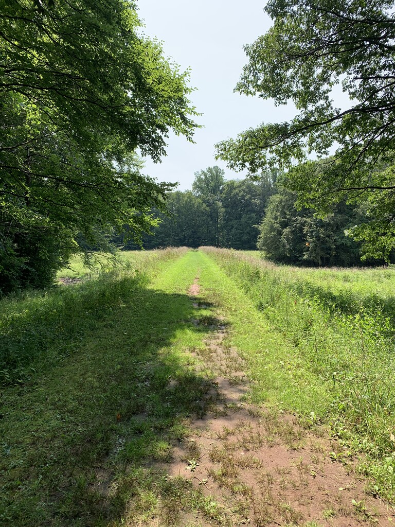
Enter West Branch Reservoir. Continue toward Pioneer Drive, but before Pioneer Drive cul-de-sac, turn onto dirt path into outskirts of Westmoor Park. Follow to gravel trail and continue to red barn. Mileage: 0.5 miles from West Branch Watershed to Westmoor Park Red Barn.
End - Westmoor Park, 119 Flagg Road (Notes: Demonstration farm, trails, community gardens, ecology education programs).